Area Overview for M44 6AX
Photos of M44 6AX

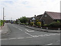


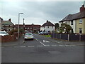
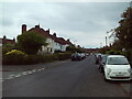
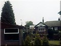
26 photos from this area
Area Information
Key information about the M44 6AX including its size, population, and administrative classification.
- Area Type
- Postcode
- Area Size
- 7747 m²
- Population
- 2550
- Population Density
- 329141 people/km²
House Prices in M44 6AX
26
Properties
£136,286
Average Sold Price
£15,000
Lowest Price
£264,000
Highest Price
Showing 26 properties
| Address | Type | Beds | Baths | Last Sale Price | Last Sale Date | |
|---|---|---|---|---|---|---|
| 25 Francis Road, Irlam, M44 6AX | Terraced | 3 | 1 | £222,000 | Oct 2023 | |
| 9 Francis Road, Irlam, M44 6AX | house | - | - | £264,000 | Sep 2021 | |
| 35 Francis Road, Irlam, M44 6AX | house | - | - | £200,000 | Feb 2021 | |
| 11 Francis Road, Irlam, M44 6AX | Terraced | 3 | 1 | £186,000 | Dec 2018 | |
| 17 Francis Road, Irlam, M44 6AX | house | - | - | £112,000 | Oct 2017 | |
| 47 Francis Road, Irlam, M44 6AX | Semi-detached | 3 | 1 | £155,000 | May 2017 | |
| 37 Francis Road, Irlam, M44 6AX | house | - | - | £105,000 | Apr 2013 | |
| 15 Francis Road, Irlam, M44 6AX | house | - | - | £85,000 | Sep 2011 | |
| 21 Francis Road, Irlam, M44 6AX | house | - | - | £116,000 | Sep 2009 | |
| 19 Francis Road, Irlam, M44 6AX | Terraced | - | - | £126,000 | Jun 2009 |
Page 1 of 3
Energy Efficiency in M44 6AX
Amenities
Schools
| Rank | School | Type | Entry gender | Ages |
|---|
Explore more schools in this area
Go to Schools tabDemographics
Household Size
Family (3-5 people)
most common
Accommodation Type
Houses
most common
Tenure
67
majority
Ethnic Group
White
most common
Religion
N/A
most common
Household Composition
N/A
most common
Age
47
median
Adults (30-64 years)
most common
Household Deprivation
N/A
with no deprivation
NS-SEC
35
in Lower managerial occupations
Explore more demographic insights in this area
Go to Demographics tabPlanning
Planning Constraints
- Flood RiskPremium
- Ramsar Wetland SitesPremium
- Area of Outstanding Natural BeautyPremium
- Protected Nature ReservePremium
- Protected WoodlandPremium