Area Overview for M44 6AR
Photos of M44 6AR


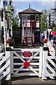
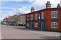


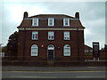
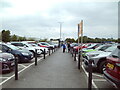
57 photos from this area
Area Information
Key information about the M44 6AR including its size, population, and administrative classification.
- Area Type
- Postcode
- Area Size
- 1.5 hectares
- Population
- 1770
- Population Density
- 201 people/km²
House Prices in M44 6AR
17
Properties
£178,773
Average Sold Price
£54,000
Lowest Price
£330,000
Highest Price
Showing 17 properties
| Address | Type | Beds | Baths | Last Sale Price | Last Sale Date | |
|---|---|---|---|---|---|---|
| 25 Roscoe Road, Irlam, M44 6AR | house | 3 | 1 | £330,000 | Dec 2022 | |
| 33 Roscoe Road, Irlam, M44 6AR | Semi-detached | 3 | 2 | £315,000 | Apr 2022 | |
| 21 Roscoe Road, Irlam, M44 6AR | house | - | - | £215,000 | Sep 2017 | |
| 46 Roscoe Road, Irlam, M44 6AR | house | - | - | £195,000 | Oct 2014 | |
| 39 Roscoe Road, Irlam, M44 6AR | house | - | - | £230,000 | Sep 2014 | |
| 48 Roscoe Road, Irlam, M44 6AR | house | - | - | £220,000 | Sep 2011 | |
| 37 Roscoe Road, Irlam, M44 6AR | Semi-detached | - | - | £117,500 | Jun 2009 | |
| 35 Roscoe Road, Irlam, M44 6AR | Semi-detached | - | - | £110,000 | Dec 2003 | |
| 29 Roscoe Road, Irlam, M44 6AR | Detached | - | - | £105,000 | Mar 2002 | |
| 27 Roscoe Road, Irlam, M44 6AR | Bungalow | - | - | £75,000 | Aug 2001 |
Page 1 of 2
Energy Efficiency in M44 6AR
Amenities
Schools
| Rank | School | Type | Entry gender | Ages |
|---|
Explore more schools in this area
Go to Schools tabDemographics
Household Size
One person
most common
Accommodation Type
Houses
most common
Tenure
47
majority
Ethnic Group
White
most common
Religion
N/A
most common
Household Composition
N/A
most common
Age
47
median
Adults (30-64 years)
most common
Household Deprivation
N/A
with no deprivation
NS-SEC
25
in Lower managerial occupations
Explore more demographic insights in this area
Go to Demographics tabPlanning
Planning Constraints
- Flood RiskPremium
- Ramsar Wetland SitesPremium
- Area of Outstanding Natural BeautyPremium
- Protected Nature ReservePremium
- Protected WoodlandPremium