Area Overview for M44 5PP
Photos of M44 5PP


Area Information
Living in M44 5PP means inhabiting a compact residential cluster in England, home to 2,080 people spread across 1.52 km². The area’s population density of 1,372 people per square kilometre reflects its small, tightly knit character. This is a community shaped by adults aged 30–64, with a median age of 47, suggesting a stable, established demographic. The area’s housing stock is predominantly owner-occupied, with 57% of homes owned by residents, and most properties are houses rather than flats. The White ethnic group forms the majority, contributing to a familiar social fabric. Daily life here is defined by proximity to essential services and transport links. Residents benefit from nearby rail stations, including Irlam and Glazebrook, and proximity to Manchester’s City Airport. The area’s compact size means amenities are within walking or cycling distance, though its small scale also means limited options for expansion or development. For those seeking a quiet, residential environment with practical connectivity, M44 5PP offers a blend of stability and accessibility.
- Area Type
- Postcode
- Area Size
- Not available
- Population
- 2080
- Population Density
- 1372 people/km²
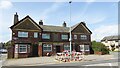
The property market in M44 5PP is dominated by owner-occupied homes, with 57% of properties owned by residents. This contrasts with areas where rental markets dominate, suggesting a community of long-term residents rather than transient tenants. The accommodation type is predominantly houses, which is unusual in many modern residential clusters where flats are more common. This housing stock reflects the area’s demographic profile of older, established households. The small size of M44 5PP means the available housing stock is limited, which could make the area competitive for buyers. For those seeking a home, the focus on houses may appeal to families or individuals prioritising space and privacy. However, the limited number of properties also means buyers should consider nearby areas for broader options. The high home ownership rate indicates a stable market, but the small scale of the area means it is not a destination for large-scale property investment.
House Prices in M44 5PP
Showing 1 properties
| Address | Type | Beds | Baths | Last Sale Price | Last Sale Date | |
|---|---|---|---|---|---|---|
| Perkins Powerpart Distribution Centre, Frank Perkins Way, Irlam, M44 5PP | storage_distribution | - | - | - | - |
Energy Efficiency in M44 5PP
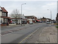
The lifestyle in M44 5PP is shaped by its proximity to essential retail and transport hubs. Nearby shops include Tesco Irlam, Lidl Irlam, and Tesco Central, providing access to groceries and daily necessities. The area’s rail and metro stations connect residents to broader networks, with Trafford Centre and Barton Dock Road offering additional transit points. Manchester’s City Airport is a notable feature, enabling easy travel for those requiring frequent flights. While the area lacks large-scale leisure facilities, its compact size ensures amenities are within walking distance. The retail options and transport links contribute to a convenient, practical lifestyle. However, the absence of parks or recreational spaces in the data suggests that outdoor activities may require travel beyond the immediate area. The balance of retail, transport, and proximity to an airport makes M44 5PP appealing for those prioritising accessibility over expansive leisure options.
Amenities
Schools
Residents of M44 5PP have access to two primary schools within practical reach: Cadishead Infant School and St Mary’s CofE Primary School. Both cater to younger children, with St Mary’s holding an Ofsted rating of ‘good’. This mix of school types provides families with options for early education, though no secondary schools are listed in the data. The presence of two primary schools suggests a focus on foundational education, which is critical for young families. However, the absence of secondary schools may require parents to look beyond the immediate area for secondary education. For those prioritising primary schooling, the availability of a ‘good’ rated school is a positive factor. The compact nature of M44 5PP means schools are accessible by foot or short drive, enhancing convenience for families.
| Rank | School | Type | Entry gender | Ages |
|---|
Explore more schools in this area
Go to Schools tabDemographics
The community in M44 5PP is predominantly composed of adults aged 30–64, with a median age of 47. This suggests a mature, established population with a strong presence of middle-aged households. Home ownership is high, at 57%, indicating a preference for long-term residency over rental properties. The area is characterised by houses rather than flats, which aligns with the demographic profile of older, settled residents. The predominant ethnic group is White, which shapes the cultural and social dynamics of the area. While no specific data on deprivation is provided, the high home ownership rate and age profile imply a relatively stable economic environment. However, the absence of detailed diversity metrics means the full range of community experiences remains unexplored. The area’s compact size and mature population suggest a focus on family-oriented living, with limited scope for younger, transient demographics.
Household Size
Accommodation Type
Tenure
Ethnic Group
Religion
Household Composition
Age
Household Deprivation
NS-SEC
Explore more demographic insights in this area
Go to Demographics tabPlanning
Planning Constraints
- Flood RiskPremium
- Ramsar Wetland SitesPremium
- Area of Outstanding Natural BeautyPremium
- Protected Nature ReservePremium
- Protected WoodlandPremium