Area Overview for M44 5LF
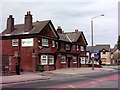
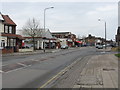
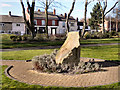
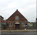
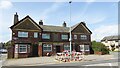
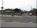
Photos of M44 5LF


Area Information
Living in M44 5LF means inhabiting a tightly knit residential cluster in England, covering just 3 hectares. With a population of 2080 people, the area is compact but offers a mix of daily conveniences. The median age of 47 suggests a mature community, with adults aged 30–64 forming the largest demographic. Daily life here is shaped by proximity to amenities: five rail stations, including Irlam and Glazebrook, provide easy access to nearby towns, while retail hubs like Tesco Central and Heron Partington cater to everyday needs. The area’s small size means residents are close to schools, such as St Mary’s CofE Primary School, which holds a ‘good’ Ofsted rating. Despite its modest footprint, M44 5LF balances practicality with accessibility, offering a quiet residential environment within reach of Manchester’s broader infrastructure, including City Airport. The high broadband score of 97 ensures reliable internet, supporting both work and leisure. However, the area’s compact nature means buyers should consider nearby zones for more extensive options.
- Area Type
- Postcode
- Area Size
- 3.0 hectares
- Population
- 2080
- Population Density
- 1372 people/km²
The property market in M44 5LF is dominated by owner-occupied homes, with 57% of properties owned by residents rather than rented. Houses, not flats, are the primary accommodation type, suggesting a focus on family homes and long-term residency. This contrasts with areas where rental demand drives property typologies. The small area size—just 3 hectares—means the housing stock is limited, with few new developments likely. Buyers should consider nearby zones for more extensive options, though M44 5LF’s proximity to rail and metro stations, such as Timperley and Brooklands, may offset its compact footprint. The high broadband score of 97 also supports remote work, potentially appealing to professionals. However, the area’s small size and high population density mean competition for properties could be fierce, particularly for homes near schools like St Mary’s CofE Primary School.
House Prices in M44 5LF
No properties found in this postcode.
Energy Efficiency in M44 5LF
The lifestyle in M44 5LF is shaped by its proximity to retail, transport, and leisure options. Within practical reach are Tesco Central, Heron Partington, and Tesco Irlam, providing everyday shopping needs. Rail stations like Irlam and Glazebrook, plus metro stops such as Timperley and Brooklands, ensure easy access to work, schools, and leisure. The area’s connection to Trafford Centre adds a layer of convenience for dining, shopping, and entertainment. While the data does not specify parks or green spaces, the absence of protected natural areas suggests a focus on urban living. The compact nature of the area means residents are close to amenities but may need to travel for more extensive recreational options. Overall, M44 5LF offers a blend of practicality and accessibility, with daily life revolving around local shops, transport hubs, and nearby urban centres.
Amenities
Schools
Residents of M44 5LF have access to two primary schools: Cadishead Infant School and St Mary’s CofE Primary School. Both cater to younger children, with St Mary’s holding a ‘good’ Ofsted rating, indicating a reliable educational standard. The presence of two primary schools within practical reach suggests a focus on early education, which is essential for families with young children. However, the data does not mention secondary schools or further education options, meaning parents may need to look beyond the immediate area for comprehensive schooling. The mix of school types—both state and church-affiliated—offers some choice, though the limited number of institutions may necessitate commuting for older students. For families prioritising primary education, the proximity of these schools is a key advantage, but the absence of secondary options is a consideration for long-term planning.
| Rank | School | Type | Entry gender | Ages |
|---|
Explore more schools in this area
Go to Schools tabDemographics
The community in M44 5LF is predominantly composed of adults aged 30–64, with a median age of 47. Home ownership stands at 57%, indicating a stable, long-term resident base. The area is characterised by houses rather than flats, reflecting a preference for family-friendly living. The predominant ethnic group is White, though no specific data on diversity or deprivation is provided. The population density of 1372 people per square kilometre suggests a densely populated yet small cluster, where social interactions are likely frequent. The absence of specific data on deprivation means it is unclear how this affects local services or quality of life. However, the age profile and home ownership rate imply a community focused on stability and established living, with fewer transient residents. This demographic structure may influence local amenities, such as schools and retail, which are tailored to a mature, family-oriented population.
Household Size
Accommodation Type
Tenure
Ethnic Group
Religion
Household Composition
Age
Household Deprivation
NS-SEC
Explore more demographic insights in this area
Go to Demographics tabPlanning
Planning Constraints
- Flood RiskPremium
- Ramsar Wetland SitesPremium
- Area of Outstanding Natural BeautyPremium
- Protected Nature ReservePremium
- Protected WoodlandPremium