Area Overview for M43 7WA
Photos of M43 7WA

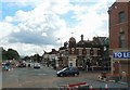
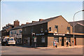


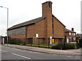
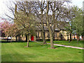

100 photos from this area
Area Information
Key information about the M43 7WA including its size, population, and administrative classification.
- Area Type
- Postcode
- Area Size
- 5742 m²
- Population
- 1524
- Population Density
- 7043 people/km²
House Prices in M43 7WA
16
Properties
£122,694
Average Sold Price
£55,000
Lowest Price
£230,000
Highest Price
Showing 16 properties
| Address | Type | Beds | Baths | Last Sale Price | Last Sale Date | |
|---|---|---|---|---|---|---|
| 45 Chappell Road, Droylsden, M43 7WA | Retail | 3 | 1 | £230,000 | Mar 2022 | |
| 55 Chappell Road, Droylsden, M43 7WA | Detached | 3 | 1 | £185,000 | Mar 2020 | |
| 29 Chappell Road, Droylsden, M43 7WA | Semi-detached | 2 | 1 | £110,000 | Apr 2015 | |
| 53 Chappell Road, Droylsden, M43 7WA | Detached | 3 | 1 | £131,500 | Mar 2012 | |
| 33 Chappell Road, Droylsden, M43 7WA | house | 3 | 1 | £95,000 | Sep 2010 | |
| 43 Chappell Road, Droylsden, M43 7WA | house | - | - | £122,750 | May 2009 | |
| 47 Chappell Road, Droylsden, M43 7WA | Semi-detached | - | - | £115,000 | Apr 2004 | |
| 39 Chappell Road, Droylsden, M43 7WA | Detached | - | - | £60,000 | Sep 1998 | |
| 37 Chappell Road, Droylsden, M43 7WA | house | 3 | - | £55,000 | Mar 1995 | |
| 51 Chappell Road, Droylsden, M43 7WA | Semi-detached | 3 | 1 | - | - |
Page 1 of 2
Energy Efficiency in M43 7WA
Amenities
Schools
| Rank | School | Type | Entry gender | Ages |
|---|
Explore more schools in this area
Go to Schools tabDemographics
Household Size
Family (3-5 people)
most common
Accommodation Type
Houses
most common
Tenure
84
majority
Ethnic Group
White
most common
Religion
N/A
most common
Household Composition
N/A
most common
Age
47
median
Adults (30-64 years)
most common
Household Deprivation
N/A
with no deprivation
NS-SEC
28
in Lower managerial occupations
Explore more demographic insights in this area
Go to Demographics tabPlanning
Planning Constraints
- Flood RiskPremium
- Ramsar Wetland SitesPremium
- Area of Outstanding Natural BeautyPremium
- Protected Nature ReservePremium
- Protected WoodlandPremium