Area Overview for M43 7FA
Photos of M43 7FA


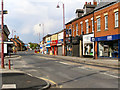
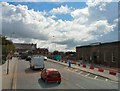
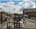
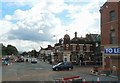
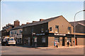


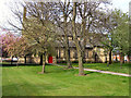

100 photos from this area
Area Information
Key information about the M43 7FA including its size, population, and administrative classification.
- Area Type
- Postcode
- Area Size
- 9712 m²
- Population
- 1536
- Population Density
- 4997 people/km²
House Prices in M43 7FA
26
Properties
£114,121
Average Sold Price
£24,000
Lowest Price
£207,000
Highest Price
Showing 26 properties
| Address | Type | Beds | Baths | Last Sale Price | Last Sale Date | |
|---|---|---|---|---|---|---|
| 9 Lines Road, Droylsden, M43 7FA | Semi-detached | 2 | 1 | £202,000 | Nov 2025 | |
| 27 Lines Road, Droylsden, M43 7FA | Semi-detached | 2 | 1 | £187,000 | Feb 2024 | |
| 22 Lines Road, Droylsden, M43 7FA | Semi-detached | 2 | - | £207,000 | Jul 2023 | |
| 16 Lines Road, Droylsden, M43 7FA | Semi-detached | 3 | 2 | £172,000 | Jun 2019 | |
| 7 Lines Road, Droylsden, M43 7FA | house | - | - | £70,000 | Mar 2019 | |
| 29 Lines Road, Droylsden, M43 7FA | house | 2 | - | £110,000 | Sep 2017 | |
| 4 Lines Road, Droylsden, M43 7FA | Semi-detached | 2 | 1 | £95,000 | Apr 2017 | |
| 8 Lines Road, Droylsden, M43 7FA | house | 2 | 1 | £90,000 | Oct 2015 | |
| 18 Lines Road, Droylsden, M43 7FA | Semi-detached | - | - | £65,000 | May 2015 | |
| 1 Lines Road, Droylsden, M43 7FA | house | - | - | £140,000 | Sep 2014 |
Page 1 of 3
Energy Efficiency in M43 7FA
Amenities
Schools
| Rank | School | Type | Entry gender | Ages |
|---|
Explore more schools in this area
Go to Schools tabDemographics
Household Size
One person
most common
Accommodation Type
Houses
most common
Tenure
66
majority
Ethnic Group
White
most common
Religion
N/A
most common
Household Composition
N/A
most common
Age
47
median
Adults (30-64 years)
most common
Household Deprivation
N/A
with no deprivation
NS-SEC
26
in Lower managerial occupations
Explore more demographic insights in this area
Go to Demographics tabPlanning
Planning Constraints
- Flood RiskPremium
- Ramsar Wetland SitesPremium
- Area of Outstanding Natural BeautyPremium
- Protected Nature ReservePremium
- Protected WoodlandPremium