Area Overview for M43 6QA
Photos of M43 6QA

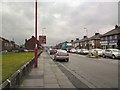
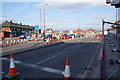
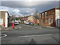

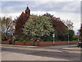
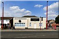


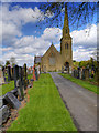
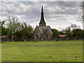
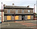
83 photos from this area
Area Information
Key information about the M43 6QA including its size, population, and administrative classification.
- Area Type
- Postcode
- Area Size
- 6.4 hectares
- Population
- 1370
- Population Density
- 5754 people/km²
House Prices in M43 6QA
15
Properties
£135,175
Average Sold Price
£88,500
Lowest Price
£235,000
Highest Price
Showing 15 properties
| Address | Type | Beds | Baths | Last Sale Price | Last Sale Date | |
|---|---|---|---|---|---|---|
| 13 Manor Road, Droylsden, M43 6QA | Semi-detached | 3 | 1 | £235,000 | Feb 2024 | |
| 25 Manor Road, Droylsden, M43 6QA | Bungalow | - | - | £119,950 | Aug 2016 | |
| 27 Manor Road, Droylsden, M43 6QA | Bungalow | 2 | 1 | £138,000 | Dec 2014 | |
| 21 Manor Road, Droylsden, M43 6QA | Semi-detached | 3 | 1 | £124,950 | Jul 2013 | |
| 9 Manor Road, Droylsden, M43 6QA | house | - | - | £115,000 | Jan 2012 | |
| 23 Manor Road, Droylsden, M43 6QA | Semi-detached | - | - | £150,000 | Nov 2006 | |
| 15 Manor Road, Droylsden, M43 6QA | house | 3 | - | £110,000 | Feb 2006 | |
| 11 Manor Road, Droylsden, M43 6QA | Semi-detached | - | - | £88,500 | May 2003 | |
| Depot, Manor Road, Droylsden, M43 6QA | warehouse | - | - | - | - | |
| Mortuary Chapel, Droylsden Cemetery, Manor Road, Droylsden, M43 6QA | commercial | - | - | - | - |
Page 1 of 2
Energy Efficiency in M43 6QA
Amenities
Schools
| Rank | School | Type | Entry gender | Ages |
|---|
Explore more schools in this area
Go to Schools tabDemographics
Household Size
Family (3-5 people)
most common
Accommodation Type
Houses
most common
Tenure
72
majority
Ethnic Group
White
most common
Religion
N/A
most common
Household Composition
N/A
most common
Age
47
median
Adults (30-64 years)
most common
Household Deprivation
N/A
with no deprivation
NS-SEC
25
in Lower managerial occupations
Explore more demographic insights in this area
Go to Demographics tabPlanning
Planning Constraints
- Flood RiskPremium
- Ramsar Wetland SitesPremium
- Area of Outstanding Natural BeautyPremium
- Protected Nature ReservePremium
- Protected WoodlandPremium