Area Overview for M43 6AN
Photos of M43 6AN


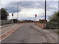
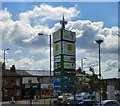
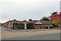
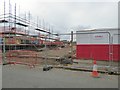
100 photos from this area
Area Information
Key information about the M43 6AN including its size, population, and administrative classification.
- Area Type
- Postcode
- Area Size
- 7712 m²
- Population
- 2190
- Population Density
- 6368 people/km²
House Prices in M43 6AN
35
Properties
£90,335
Average Sold Price
£26,500
Lowest Price
£210,000
Highest Price
Showing 35 properties
| Address | Type | Beds | Baths | Last Sale Price | Last Sale Date | |
|---|---|---|---|---|---|---|
| 286 Fairfield Road, Droylsden, M43 6AN | house | - | - | £110,000 | Jan 2025 | |
| 276 Fairfield Road, Droylsden, M43 6AN | house | - | - | £110,000 | May 2024 | |
| 250 Fairfield Road, Droylsden, M43 6AN | Terraced | 2 | 1 | £121,500 | Jun 2022 | |
| 282 Fairfield Road, Droylsden, M43 6AN | house | - | - | £210,000 | Aug 2021 | |
| 278 Fairfield Road, Droylsden, M43 6AN | Terraced | 2 | 1 | £101,500 | Apr 2021 | |
| 292 Fairfield Road, Droylsden, M43 6AN | Terraced | 2 | 1 | £86,000 | Nov 2020 | |
| 306 Fairfield Road, Droylsden, M43 6AN | Terraced | 3 | 1 | £150,000 | Jun 2019 | |
| 288 Fairfield Road, Droylsden, M43 6AN | Terraced | 2 | 1 | £93,000 | Nov 2018 | |
| 280 Fairfield Road, Droylsden, M43 6AN | house | 4 | 1 | £170,000 | May 2018 | |
| 290 Fairfield Road, Droylsden, M43 6AN | Terraced | 2 | 2 | £91,500 | Nov 2017 |
Page 1 of 4
Energy Efficiency in M43 6AN
Amenities
Schools
| Rank | School | Type | Entry gender | Ages |
|---|
Explore more schools in this area
Go to Schools tabDemographics
Household Size
Family (3-5 people)
most common
Accommodation Type
Houses
most common
Tenure
47
majority
Ethnic Group
White
most common
Religion
N/A
most common
Household Composition
N/A
most common
Age
47
median
Adults (30-64 years)
most common
Household Deprivation
N/A
with no deprivation
NS-SEC
27
in Lower managerial occupations
Explore more demographic insights in this area
Go to Demographics tabPlanning
Planning Constraints
- Flood RiskPremium
- Ramsar Wetland SitesPremium
- Area of Outstanding Natural BeautyPremium
- Protected Nature ReservePremium
- Protected WoodlandPremium