Area Overview for M41 9WA
Photos of M41 9WA
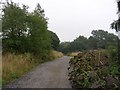

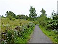
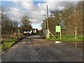
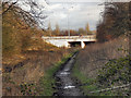


27 photos from this area
Area Information
Key information about the M41 9WA including its size, population, and administrative classification.
- Area Type
- Postcode
- Area Size
- 16.1 hectares
- Population
- 1699
- Population Density
- 1156 people/km²
House Prices in M41 9WA
17
Properties
£243,068
Average Sold Price
£46,750
Lowest Price
£440,000
Highest Price
Showing 17 properties
| Address | Type | Beds | Baths | Last Sale Price | Last Sale Date | |
|---|---|---|---|---|---|---|
| 27 Loretto Road, Urmston, M41 9WA | Semi-detached | 3 | 1 | £380,000 | Mar 2025 | |
| 41 Loretto Road, Urmston, M41 9WA | Bungalow | 3 | 2 | £419,000 | Jan 2021 | |
| 31 Loretto Road, Urmston, M41 9WA | Semi-detached | 4 | 1 | £415,000 | Oct 2020 | |
| 17 Loretto Road, Urmston, M41 9WA | house | - | - | £190,000 | Mar 2019 | |
| 39 Loretto Road, Urmston, M41 9WA | Detached | 4 | 2 | £440,000 | Dec 2018 | |
| 15 Loretto Road, Urmston, M41 9WA | Semi-detached | 3 | 2 | £180,000 | Nov 2017 | |
| 19 Loretto Road, Urmston, M41 9WA | house | - | - | £174,000 | Jun 2015 | |
| 21 Loretto Road, Urmston, M41 9WA | house | 3 | - | £145,000 | Mar 2012 | |
| 33 Loretto Road, Urmston, M41 9WA | house | 4 | - | £176,000 | Jul 2011 | |
| 9 Loretto Road, Urmston, M41 9WA | Semi-detached | - | - | £108,000 | Feb 2003 |
Page 1 of 2
Energy Efficiency in M41 9WA
Amenities
Schools
| Rank | School | Type | Entry gender | Ages |
|---|
Explore more schools in this area
Go to Schools tabDemographics
Household Size
One person
most common
Accommodation Type
Houses
most common
Tenure
63
majority
Ethnic Group
White
most common
Religion
N/A
most common
Household Composition
N/A
most common
Age
47
median
Adults (30-64 years)
most common
Household Deprivation
N/A
with no deprivation
NS-SEC
33
in Lower managerial occupations
Explore more demographic insights in this area
Go to Demographics tabPlanning
Planning Constraints
- Flood RiskPremium
- Ramsar Wetland SitesPremium
- Area of Outstanding Natural BeautyPremium
- Protected Nature ReservePremium
- Protected WoodlandPremium