Area Overview for M41 9EF
Photos of M41 9EF

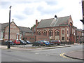
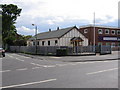
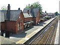
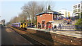
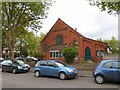

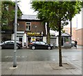
60 photos from this area
Area Information
Key information about the M41 9EF including its size, population, and administrative classification.
- Area Type
- Postcode
- Area Size
- 3135 m²
- Population
- 1467
- Population Density
- 5939 people/km²
House Prices in M41 9EF
16
Properties
£202,677
Average Sold Price
£74,000
Lowest Price
£415,000
Highest Price
Showing 16 properties
| Address | Type | Beds | Baths | Last Sale Price | Last Sale Date | |
|---|---|---|---|---|---|---|
| 3 Dartford Road, Urmston, M41 9EF | Terraced | 3 | 1 | £415,000 | Dec 2023 | |
| 5 Dartford Road, Urmston, M41 9EF | Terraced | 3 | 2 | £255,000 | Sep 2017 | |
| 27 Dartford Road, Urmston, M41 9EF | Terraced | 3 | - | £255,000 | May 2016 | |
| 25 Dartford Road, Urmston, M41 9EF | Terraced | 3 | 1 | £230,000 | Oct 2015 | |
| 21 Dartford Road, Urmston, M41 9EF | house | - | - | £239,950 | Oct 2015 | |
| 13 Dartford Road, Urmston, M41 9EF | house | 2 | - | £161,000 | Mar 2011 | |
| 19 Dartford Road, Urmston, M41 9EF | Terraced | - | - | £100,000 | Jan 2008 | |
| 11 Dartford Road, Urmston, M41 9EF | Terraced | - | - | £157,500 | Jan 2008 | |
| 29 Dartford Road, Urmston, M41 9EF | Terraced | 2 | 1 | £180,000 | Sep 2007 | |
| 15 Dartford Road, Urmston, M41 9EF | Semi-detached | - | - | £162,000 | May 2006 |
Page 1 of 2
Energy Efficiency in M41 9EF
Amenities
Schools
| Rank | School | Type | Entry gender | Ages |
|---|
Explore more schools in this area
Go to Schools tabDemographics
Household Size
One person
most common
Accommodation Type
Houses
most common
Tenure
69
majority
Ethnic Group
White
most common
Religion
N/A
most common
Household Composition
N/A
most common
Age
47
median
Adults (30-64 years)
most common
Household Deprivation
N/A
with no deprivation
NS-SEC
45
in Lower managerial occupations
Explore more demographic insights in this area
Go to Demographics tabPlanning
Planning Constraints
- Flood RiskPremium
- Ramsar Wetland SitesPremium
- Area of Outstanding Natural BeautyPremium
- Protected Nature ReservePremium
- Protected WoodlandPremium