Area Overview for M41 9BD
Photos of M41 9BD
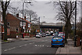
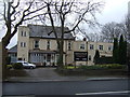
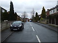
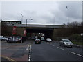
30 photos from this area
Area Information
Key information about the M41 9BD including its size, population, and administrative classification.
- Area Type
- Postcode
- Area Size
- 5676 m²
- Population
- 1537
- Population Density
- 6412 people/km²
House Prices in M41 9BD
16
Properties
£225,350
Average Sold Price
£148,600
Lowest Price
£300,000
Highest Price
Showing 16 properties
| Address | Type | Beds | Baths | Last Sale Price | Last Sale Date | |
|---|---|---|---|---|---|---|
| 177 Higher Road, Urmston, M41 9BD | Terraced | 3 | 1 | £300,000 | Nov 2024 | |
| 165 Higher Road, Urmston, M41 9BD | Terraced | 3 | 1 | £265,000 | Jul 2023 | |
| 169 Higher Road, Urmston, M41 9BD | Terraced | 2 | 1 | £200,000 | Jan 2023 | |
| 173 Higher Road, Urmston, M41 9BD | Retail | 2 | 1 | £228,500 | Mar 2022 | |
| 167 Higher Road, Urmston, M41 9BD | Terraced | 3 | 1 | £210,000 | Aug 2020 | |
| 171 Higher Road, Urmston, M41 9BD | Terraced | 3 | 1 | £148,600 | Mar 2016 | |
| 169A Higher Road, Urmston, M41 9BD | Land | - | - | - | - | |
| 185 Higher Road, Urmston, M41 9BD | Terraced | - | - | - | - | |
| 163 Higher Road, Urmston, M41 9BD | Terraced | 3 | - | - | - | |
| 175 Higher Road, Urmston, M41 9BD | Terraced | 2 | 1 | - | - |
Page 1 of 2
Energy Efficiency in M41 9BD
Amenities
Schools
| Rank | School | Type | Entry gender | Ages |
|---|
Explore more schools in this area
Go to Schools tabDemographics
Household Size
One person
most common
Accommodation Type
Houses
most common
Tenure
56
majority
Ethnic Group
White
most common
Religion
N/A
most common
Household Composition
N/A
most common
Age
47
median
Adults (30-64 years)
most common
Household Deprivation
N/A
with no deprivation
NS-SEC
39
in Lower managerial occupations
Explore more demographic insights in this area
Go to Demographics tabPlanning
Planning Constraints
- Flood RiskPremium
- Ramsar Wetland SitesPremium
- Area of Outstanding Natural BeautyPremium
- Protected Nature ReservePremium
- Protected WoodlandPremium