Area Overview for M41 7SW
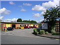
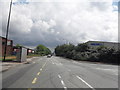
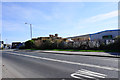
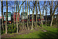
Photos of M41 7SW


Area Information
Living in M41 7SW means inhabiting a compact, residential cluster in England, where 1,448 people reside across 1.1 hectares. The area’s population density of 265 people per square kilometre suggests a tightly knit community, with homes predominantly occupied by owners. Daily life here is shaped by proximity to essential services and transport links. The area’s small size means residents are likely to know their neighbours, though the lack of natural or protected landscapes nearby points to a focus on urban convenience. Schools, retail hubs, and rail networks are within practical reach, making it a practical choice for those prioritising accessibility. However, the high crime risk reported for the area is a notable concern, requiring careful consideration for families or individuals seeking a secure environment. Despite this, the presence of well-rated primary schools and a mix of retail and transport options suggests a functional, if unremarkable, suburban existence.
- Area Type
- Postcode
- Area Size
- 1.1 hectares
- Population
- 1448
- Population Density
- 265 people/km²
M41 7SW is primarily an owner-occupied area, with 80% of homes owned by residents rather than rented. The accommodation type is predominantly houses, which is unusual for a small postcode area but may reflect the presence of larger properties or detached homes. This suggests a market skewed towards long-term buyers rather than short-term renters, potentially limiting availability for those seeking to move in. The compact size of the area means that property choices are limited, and buyers may need to look to nearby regions for more options. The high home ownership rate also indicates a stable, established market, though the lack of rental properties could make it challenging for those requiring flexibility.
House Prices in M41 7SW
No properties found in this postcode.
Energy Efficiency in M41 7SW
The lifestyle in M41 7SW is defined by proximity to retail, transport, and leisure options. Nearby, residents can access Asda Trafford, Costco Manchester, and M&S Trafford, offering a range of shopping experiences. The Trafford Centre, a major retail and entertainment hub, is a short journey away, providing dining, cinema, and shopping. Rail stations such as Patricroft and Eccles connect to regional networks, while the nearby City Airport Manchester caters to travel needs. The area’s bus services, though limited to one stop at Chorlton Street, provide local connectivity. While the lack of green spaces or parks is notable, the emphasis on urban convenience ensures that daily life is efficient, with amenities clustered for easy access. The compact nature of the area means that most needs can be met without long commutes, though those seeking natural landscapes may need to look further afield.
Amenities
Schools
Residents of M41 7SW have access to a range of educational institutions, including Kingsway Primary School, which holds an Ofsted rating of ‘good’. This school serves younger children, offering a foundation for primary education. For special needs, Urmston Parklands School and Egerton High School provide tailored support, though their specific focus areas are not detailed in the data. The presence of both primary and special schools suggests a comprehensive educational ecosystem, catering to diverse family needs. However, the absence of secondary schools in the immediate area may require families to travel further for secondary education. The mix of school types indicates a focus on inclusivity, though the lack of detailed performance metrics for the special schools leaves room for further inquiry.
| Rank | School | Type | Entry gender | Ages |
|---|
Explore more schools in this area
Go to Schools tabDemographics
The community in M41 7SW is predominantly composed of adults aged 30–64, with a median age of 47. This suggests a mature, stable population, likely with established careers and families. Home ownership is high, at 80%, indicating a preference for long-term residency over rental properties. The area’s accommodation is largely houses, which aligns with the demographic profile of older, settled residents. The predominant ethnic group is White, though no specific data on diversity or deprivation is provided. The absence of younger age groups or higher population density implies a quieter, less transient environment. For those prioritising stability and a slower pace of life, the age profile and ownership rates suggest a community focused on continuity rather than rapid change.
Household Size
Accommodation Type
Tenure
Ethnic Group
Religion
Household Composition
Age
Household Deprivation
NS-SEC
Explore more demographic insights in this area
Go to Demographics tabPlanning
Planning Constraints
- Flood RiskPremium
- Ramsar Wetland SitesPremium
- Area of Outstanding Natural BeautyPremium
- Protected Nature ReservePremium
- Protected WoodlandPremium