Area Overview for M41 7HG
Photos of M41 7HG


Area Information
Living in M41 7HG means being part of a small, tightly knit residential cluster in England. With a population of 1,448 and a density of 265 people per square kilometre, the area feels compact yet functional. The community is predominantly composed of adults aged 30–64, many of whom own their homes. This suggests a mature, stable demographic with established routines. Daily life is shaped by proximity to key amenities, from retail hubs like M&S Trafford and Asda Trafford to transport links such as Patricroft and Urmston railway stations. The area’s small size means residents are likely to know their neighbours, though the lack of large green spaces or natural reserves means the landscape is more urban than rural. For those prioritising convenience over open space, M41 7HG offers practical living with easy access to shopping, transport, and services. However, the high crime risk reported in the area is a notable challenge for potential residents.
- Area Type
- Postcode
- Area Size
- Not available
- Population
- 1448
- Population Density
- 265 people/km²
The property market in M41 7HG is characterised by a high rate of home ownership—80% of residents own their homes—which suggests a stable, long-term market. The accommodation type is predominantly houses, indicating a lack of flats or apartments. This makes the area more suited to families or individuals seeking larger properties rather than city-centre rentals. Given the small size of the postcode, the housing stock is limited, which may mean competition for available homes. Buyers should consider that the area is not a rental hotspot; most properties are owner-occupied. This dynamic could influence pricing, with demand potentially driving up values. However, the lack of new developments or planning constraints (no protected areas or AONB coverage) means there is no immediate threat to property availability.
House Prices in M41 7HG
No properties found in this postcode.
Energy Efficiency in M41 7HG
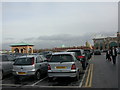
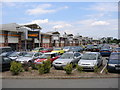
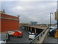
Residents of M41 7HG enjoy a lifestyle shaped by proximity to retail, transport, and leisure hubs. The area’s retail offerings include major chains such as M&S Trafford, Iceland Trafford, and Asda Trafford, providing convenience for everyday shopping. Nearby, Trafford Centre and Barton Dock Road serve as major metro and retail destinations, while railway stations like Patricroft and Urmston offer easy access to Manchester’s broader network. The City Airport Manchester is also within reach, catering to frequent travellers. For leisure, the area’s transport links facilitate trips to nearby parks, cultural venues, or dining spots. The mix of retail, transport, and services creates a practical, efficient lifestyle, though the lack of green spaces or natural attractions means the area leans heavily on urban amenities.
Amenities
Schools
Residents of M41 7HG have access to a range of schools, though the selection is limited to primary and special educational institutions. Kingsway Primary School, rated ‘good’ by Ofsted, serves the area’s younger population, offering a solid foundation for early education. Urmston Parklands School and Egerton High School are both special schools, catering to students with specific needs. This mix suggests that while there is a primary school for general education, families requiring secondary schooling may need to look beyond the immediate area. The absence of a traditional secondary school within M41 7HG itself means parents must factor in travel time to nearby districts. For those prioritising mainstream education, the proximity to Trafford’s broader school network could be a consideration.
| Rank | School | Type | Entry gender | Ages |
|---|
Explore more schools in this area
Go to Schools tabDemographics
The community in M41 7HG is defined by its age profile and home ownership rates. The median age of 47 indicates a population skewed towards middle-aged adults, with 80% of residents owning their homes. This high rate of home ownership suggests a long-term, settled community rather than a transient rental market. The predominant accommodation type is houses, which aligns with the area’s residential character. Ethnically, the population is largely White, though no specific data on other groups is provided. The age range of 30–64 years implies a workforce-centric demographic, with fewer young families or retirees. This profile may influence local services and amenities, which are tailored to adult needs rather than those of children or the elderly. The absence of detailed diversity statistics means the area’s cultural makeup remains less defined in the data.
Household Size
Accommodation Type
Tenure
Ethnic Group
Religion
Household Composition
Age
Household Deprivation
NS-SEC
Explore more demographic insights in this area
Go to Demographics tabPlanning
Planning Constraints
- Flood RiskPremium
- Ramsar Wetland SitesPremium
- Area of Outstanding Natural BeautyPremium
- Protected Nature ReservePremium
- Protected WoodlandPremium