Area Overview for M41 7ET
Photos of M41 7ET
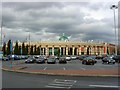
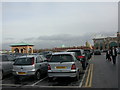

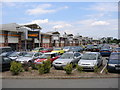
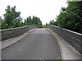


77 photos from this area
Area Information
Key information about the M41 7ET including its size, population, and administrative classification.
- Area Type
- Postcode
- Area Size
- 5676 m²
- Population
- 1448
- Population Density
- 265 people/km²
House Prices in M41 7ET
20
Properties
£198,346
Average Sold Price
£132,500
Lowest Price
£266,000
Highest Price
Showing 20 properties
| Address | Type | Beds | Baths | Last Sale Price | Last Sale Date | |
|---|---|---|---|---|---|---|
| 70 Benbecula Way, Davyhulme, M41 7ET | house | - | - | £195,000 | Sep 2025 | |
| 48 Benbecula Way, Davyhulme, M41 7ET | house | - | - | £255,000 | Jun 2024 | |
| 68 Benbecula Way, Davyhulme, M41 7ET | house | - | - | £246,000 | Jul 2022 | |
| 62 Benbecula Way, Davyhulme, M41 7ET | Semi-detached | 3 | 1 | £235,000 | Oct 2021 | |
| 72 Benbecula Way, Davyhulme, M41 7ET | house | - | - | £140,000 | Jul 2021 | |
| 64 Benbecula Way, Davyhulme, M41 7ET | house | - | - | £235,000 | Jan 2021 | |
| 52 Benbecula Way, Davyhulme, M41 7ET | Semi-detached | 3 | 2 | £266,000 | Apr 2020 | |
| 56 Benbecula Way, Davyhulme, M41 7ET | Semi-detached | 3 | 1 | £210,000 | Jan 2019 | |
| 60 Benbecula Way, Davyhulme, M41 7ET | Bungalow | - | - | £225,000 | Sep 2017 | |
| 76 Benbecula Way, Davyhulme, M41 7ET | house | 3 | - | £132,500 | Sep 2011 |
Page 1 of 2
Energy Efficiency in M41 7ET
Amenities
Schools
| Rank | School | Type | Entry gender | Ages |
|---|
Explore more schools in this area
Go to Schools tabDemographics
Household Size
Family (3-5 people)
most common
Accommodation Type
Houses
most common
Tenure
80
majority
Ethnic Group
White
most common
Religion
N/A
most common
Household Composition
N/A
most common
Age
47
median
Adults (30-64 years)
most common
Household Deprivation
N/A
with no deprivation
NS-SEC
29
in Lower managerial occupations
Explore more demographic insights in this area
Go to Demographics tabPlanning
Planning Constraints
- Flood RiskPremium
- Ramsar Wetland SitesPremium
- Area of Outstanding Natural BeautyPremium
- Protected Nature ReservePremium
- Protected WoodlandPremium