Area Overview for M41 5TF
Photos of M41 5TF

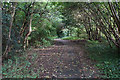
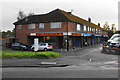
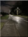

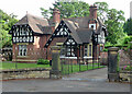
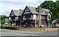
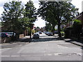
28 photos from this area
Area Information
Key information about the M41 5TF including its size, population, and administrative classification.
- Area Type
- Postcode
- Area Size
- 7701 m²
- Population
- 1671
- Population Density
- 1282 people/km²
House Prices in M41 5TF
14
Properties
£316,545
Average Sold Price
£94,000
Lowest Price
£755,000
Highest Price
Showing 14 properties
| Address | Type | Beds | Baths | Last Sale Price | Last Sale Date | |
|---|---|---|---|---|---|---|
| 10 Balmain Road, Davyhulme, M41 5TF | house | - | - | £626,000 | Sep 2022 | |
| 28 Balmain Road, Davyhulme, M41 5TF | house | - | - | £755,000 | Jun 2021 | |
| 18 Balmain Road, Davyhulme, M41 5TF | Detached | 5 | 3 | £310,000 | Apr 2017 | |
| 2 Balmain Road, Davyhulme, M41 5TF | Detached | 4 | 4 | £294,950 | Apr 2016 | |
| 26 Balmain Road, Davyhulme, M41 5TF | Detached | 4 | 1 | £292,500 | Nov 2014 | |
| 24 Balmain Road, Davyhulme, M41 5TF | Detached | - | - | £245,000 | Sep 2005 | |
| 12 Balmain Road, Davyhulme, M41 5TF | Detached | 5 | 2 | £297,000 | Apr 2005 | |
| 14 Balmain Road, Davyhulme, M41 5TF | Detached | - | - | £156,000 | Nov 2001 | |
| 22 Balmain Road, Davyhulme, M41 5TF | Detached | - | - | £94,000 | Oct 1999 | |
| 8 Balmain Road, Davyhulme, M41 5TF | Detached | - | - | £95,000 | Mar 1996 |
Page 1 of 2
Energy Efficiency in M41 5TF
Amenities
Schools
| Rank | School | Type | Entry gender | Ages |
|---|
Explore more schools in this area
Go to Schools tabDemographics
Household Size
Family (3-5 people)
most common
Accommodation Type
Houses
most common
Tenure
84
majority
Ethnic Group
White
most common
Religion
N/A
most common
Household Composition
N/A
most common
Age
47
median
Adults (30-64 years)
most common
Household Deprivation
N/A
with no deprivation
NS-SEC
41
in Lower managerial occupations
Explore more demographic insights in this area
Go to Demographics tabPlanning
Planning Constraints
- Flood RiskPremium
- Ramsar Wetland SitesPremium
- Area of Outstanding Natural BeautyPremium
- Protected Nature ReservePremium
- Protected WoodlandPremium