Area Overview for M41 5AE
Photos of M41 5AE
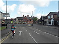

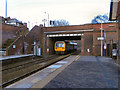

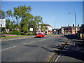

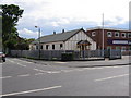
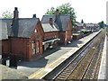
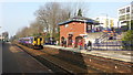
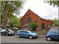

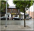
60 photos from this area
Area Information
Key information about the M41 5AE including its size, population, and administrative classification.
- Area Type
- Postcode
- Area Size
- 7900 m²
- Population
- 1467
- Population Density
- 5939 people/km²
House Prices in M41 5AE
22
Properties
£286,707
Average Sold Price
£47,750
Lowest Price
£600,000
Highest Price
Showing 22 properties
| Address | Type | Beds | Baths | Last Sale Price | Last Sale Date | |
|---|---|---|---|---|---|---|
| 28 Newton Road, Urmston, M41 5AE | Semi-detached | 3 | 1 | £355,000 | Feb 2025 | |
| 4 Newton Road, Urmston, M41 5AE | Semi-detached | 4 | 1 | £600,000 | Jul 2024 | |
| 26 Newton Road, Urmston, M41 5AE | house | - | - | £287,500 | Aug 2023 | |
| 38 Newton Road, Urmston, M41 5AE | Semi-detached | 3 | 1 | £285,000 | Jul 2019 | |
| 12 Newton Road, Urmston, M41 5AE | Terraced | 5 | 2 | £335,000 | Jun 2019 | |
| 22 Newton Road, Urmston, M41 5AE | house | - | - | £365,000 | May 2018 | |
| 40 Newton Road, Urmston, M41 5AE | house | - | - | £242,000 | Apr 2017 | |
| 14 Newton Road, Urmston, M41 5AE | Terraced | 4 | 2 | £299,995 | Jul 2015 | |
| 2 Newton Road, Urmston, M41 5AE | Semi-detached | 4 | 1 | £315,000 | Apr 2015 | |
| 18 Newton Road, Urmston, M41 5AE | Terraced | 4 | 1 | £265,000 | May 2014 |
Page 1 of 3
Energy Efficiency in M41 5AE
Amenities
Schools
| Rank | School | Type | Entry gender | Ages |
|---|
Explore more schools in this area
Go to Schools tabDemographics
Household Size
One person
most common
Accommodation Type
Houses
most common
Tenure
69
majority
Ethnic Group
White
most common
Religion
N/A
most common
Household Composition
N/A
most common
Age
47
median
Adults (30-64 years)
most common
Household Deprivation
N/A
with no deprivation
NS-SEC
45
in Lower managerial occupations
Explore more demographic insights in this area
Go to Demographics tabPlanning
Planning Constraints
- Flood RiskPremium
- Ramsar Wetland SitesPremium
- Area of Outstanding Natural BeautyPremium
- Protected Nature ReservePremium
- Protected WoodlandPremium