Area Overview for M41 0UD
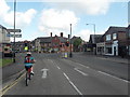
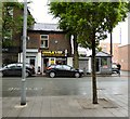
Photos of M41 0UD


Area Information
Living in M41 0UD means being part of a small, tightly knit residential cluster in England, home to 1,462 people. The area’s compact size fosters a quiet, community-oriented lifestyle, with homes primarily occupied by owner-occupiers. Daily life here is shaped by proximity to essential services, including multiple retail outlets like Sainsburys Urmston and Tesco Urmston, and easy access to rail networks such as Urmston Railway Station. The median age of 47 suggests a mature population, with adults aged 30–64 forming the majority. While the area lacks large-scale amenities, its practical connectivity to nearby hubs like Trafford Centre and Manchester’s City Airport makes it appealing for those balancing local convenience with regional access. The low flood risk and absence of environmental restrictions contribute to a stable living environment, though residents should be aware of the high crime risk in the area. For buyers seeking a manageable, family-friendly space with straightforward transport options, M41 0UD offers a straightforward proposition.
- Area Type
- Postcode
- Area Size
- Not available
- Population
- 1462
- Population Density
- 4888 people/km²
The property market in M41 0UD is characterised by a high rate of home ownership (63%), with houses forming the primary accommodation type. This suggests a market skewed towards owner-occupiers rather than renters, which may limit availability for those seeking to lease. The small size of the area means the housing stock is likely limited, with properties concentrated in a compact cluster. Buyers should consider the proximity to nearby areas for broader options, though the data does not specify rental availability. The prevalence of houses indicates a focus on private, family-oriented living, which may appeal to those prioritising space and long-term stability. However, the high crime risk in the area could influence property values and desirability, though this is not quantified in the data. For those seeking a quiet, owner-occupied home with straightforward transport links, M41 0UD presents a niche opportunity.
House Prices in M41 0UD
No properties found in this postcode.
Energy Efficiency in M41 0UD
Residents of M41 0UD have access to a range of practical amenities within walking or short driving distance. Retail options include major chains like Sainsburys Urmston, Iceland Urmston, and Tesco Urmston, ensuring everyday shopping needs are met. The area’s rail network, with stations such as Urmston and Chassen Road, connects to broader transport systems, while metro links like Trafford Centre offer regional access. For leisure, the proximity to Manchester’s City Airport and nearby parks (though not named in the data) may provide recreational opportunities. The presence of multiple rail and metro stops suggests a lifestyle that balances local convenience with the ability to commute further afield. While the area lacks large-scale entertainment venues, its compact design ensures amenities are easily reachable, supporting a low-maintenance, practical lifestyle.
Amenities
Schools
| Rank | School | Type | Entry gender | Ages |
|---|
Explore more schools in this area
Go to Schools tabDemographics
The community in M41 0UD is predominantly composed of adults aged 30–64, with a median age of 47. This suggests a population largely settled in careers and family life, with fewer young families or retirees compared to other areas. Home ownership is strong, at 63%, reflecting a preference for long-term residency over rental properties. The accommodation type is primarily houses, which aligns with the area’s residential character and may indicate a focus on private, spacious living. The predominant ethnic group is White, though no specific data on diversity or deprivation is provided. The absence of detailed diversity statistics means the community’s cultural composition remains undefined in the data. For those considering M41 0UD, the age profile and home ownership rate suggest a stable, low-turnover environment, with residents likely prioritising security and familiarity over rapid change.
Household Size
Accommodation Type
Tenure
Ethnic Group
Religion
Household Composition
Age
Household Deprivation
NS-SEC
Explore more demographic insights in this area
Go to Demographics tabPlanning
Planning Constraints
- Flood RiskPremium
- Ramsar Wetland SitesPremium
- Area of Outstanding Natural BeautyPremium
- Protected Nature ReservePremium
- Protected WoodlandPremium