Area Overview for M40 9DF
Photos of M40 9DF
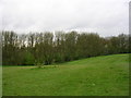
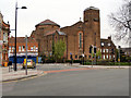
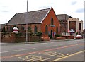

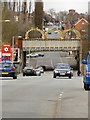
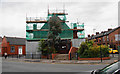
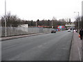
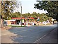
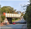
36 photos from this area
Area Information
Key information about the M40 9DF including its size, population, and administrative classification.
- Area Type
- Postcode
- Area Size
- 6799 m²
- Population
- 2093
- Population Density
- 8072 people/km²
House Prices in M40 9DF
34
Properties
£242,625
Average Sold Price
£14,000
Lowest Price
£1,100,000
Highest Price
Showing 34 properties
| Address | Type | Beds | Baths | Last Sale Price | Last Sale Date | |
|---|---|---|---|---|---|---|
| 140 Kenyon Lane, Manchester, M40 9DF | Terraced | 3 | 1 | £191,000 | Dec 2023 | |
| 152 Kenyon Lane, Manchester, M40 9DF | Semi-detached | 3 | 2 | £245,000 | Jun 2023 | |
| Highfield Care Home, 130 Kenyon Lane, Manchester, M40 9DF | Retirement | - | - | £1,100,000 | Oct 2020 | |
| 148 Kenyon Lane, Manchester, M40 9DF | house | 2 | 1 | £111,000 | Sep 2020 | |
| 136 Kenyon Lane, Manchester, M40 9DF | Terraced | 3 | 1 | £110,000 | Jul 2019 | |
| 150 Kenyon Lane, Manchester, M40 9DF | house | - | - | £85,000 | Mar 2018 | |
| 138 Kenyon Lane, Manchester, M40 9DF | Terraced | 2 | 1 | £85,000 | Oct 2017 | |
| 146 Kenyon Lane, Manchester, M40 9DF | Terraced | 2 | 1 | £14,000 | Aug 1998 | |
| 144 Kenyon Lane, Manchester, M40 9DF | house | - | - | - | - | |
| 142 Kenyon Lane, Manchester, M40 9DF | house | - | - | - | - |
Page 1 of 4
Energy Efficiency in M40 9DF
Amenities
Schools
| Rank | School | Type | Entry gender | Ages |
|---|
Explore more schools in this area
Go to Schools tabDemographics
Household Size
Family (3-5 people)
most common
Accommodation Type
Houses
most common
Tenure
38
majority
Ethnic Group
White
most common
Religion
N/A
most common
Household Composition
N/A
most common
Age
47
median
Adults (30-64 years)
most common
Household Deprivation
N/A
with no deprivation
NS-SEC
16
in Lower managerial occupations
Explore more demographic insights in this area
Go to Demographics tabPlanning
Planning Constraints
- Flood RiskPremium
- Ramsar Wetland SitesPremium
- Area of Outstanding Natural BeautyPremium
- Protected Nature ReservePremium
- Protected WoodlandPremium