Area Overview for M40 8NT
Photos of M40 8NT
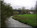
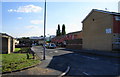
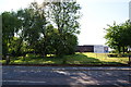

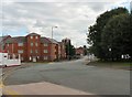


100 photos from this area
Area Information
Key information about the M40 8NT including its size, population, and administrative classification.
- Area Type
- Postcode
- Area Size
- 3.9 hectares
- Population
- 1397
- Population Density
- 4123 people/km²
House Prices in M40 8NT
15
Properties
£110,980
Average Sold Price
£81,995
Lowest Price
£160,000
Highest Price
Showing 15 properties
| Address | Type | Beds | Baths | Last Sale Price | Last Sale Date | |
|---|---|---|---|---|---|---|
| 9 Silchester Drive, Manchester, M40 8NT | house | - | - | £130,000 | Mar 2024 | |
| 27 Silchester Drive, Manchester, M40 8NT | house | - | - | £160,000 | Oct 2021 | |
| 7 Silchester Drive, Manchester, M40 8NT | house | 3 | - | £100,000 | Oct 2021 | |
| 23 Silchester Drive, Manchester, M40 8NT | Terraced | 3 | 2 | £123,000 | Aug 2019 | |
| 21 Silchester Drive, Manchester, M40 8NT | Semi-detached | 3 | 2 | £103,000 | Oct 2017 | |
| 3 Silchester Drive, Manchester, M40 8NT | Semi-detached | 3 | 2 | £104,000 | Feb 2017 | |
| 2A Silchester Drive, Manchester, M40 8NT | Semi-detached | - | - | £115,000 | May 2007 | |
| 5 Silchester Drive, Manchester, M40 8NT | Flat | 2 | 1 | £93,500 | Apr 2006 | |
| 1 Silchester Drive, Manchester, M40 8NT | Semi-detached | - | - | £104,250 | Oct 2005 | |
| 25 Silchester Drive, Manchester, M40 8NT | house | - | - | £121,995 | Jul 2004 |
Page 1 of 2
Energy Efficiency in M40 8NT
Amenities
Schools
| Rank | School | Type | Entry gender | Ages |
|---|
Explore more schools in this area
Go to Schools tabDemographics
Household Size
One person
most common
Accommodation Type
Houses
most common
Tenure
14
majority
Ethnic Group
White
most common
Religion
N/A
most common
Household Composition
N/A
most common
Age
47
median
Adults (30-64 years)
most common
Household Deprivation
N/A
with no deprivation
NS-SEC
11
in Lower managerial occupations
Explore more demographic insights in this area
Go to Demographics tabPlanning
Planning Constraints
- Flood RiskPremium
- Ramsar Wetland SitesPremium
- Area of Outstanding Natural BeautyPremium
- Protected Nature ReservePremium
- Protected WoodlandPremium