Area Overview for M40 8NN
Photos of M40 8NN
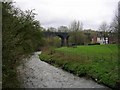
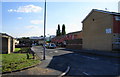
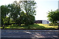
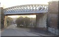


100 photos from this area
Area Information
Key information about the M40 8NN including its size, population, and administrative classification.
- Area Type
- Postcode
- Area Size
- 6036 m²
- Population
- 1776
- Population Density
- 4942 people/km²
House Prices in M40 8NN
27
Properties
£115,378
Average Sold Price
£77,995
Lowest Price
£170,000
Highest Price
Showing 27 properties
| Address | Type | Beds | Baths | Last Sale Price | Last Sale Date | |
|---|---|---|---|---|---|---|
| 37 Signal Drive, Manchester, M40 8NN | Semi-detached | 3 | 2 | £160,000 | Jan 2025 | |
| 71 Signal Drive, Manchester, M40 8NN | Terraced | - | - | £159,000 | Aug 2023 | |
| 55 Signal Drive, Manchester, M40 8NN | Semi-detached | 3 | 2 | £170,000 | Nov 2022 | |
| 51 Signal Drive, Manchester, M40 8NN | Terraced | 3 | 1 | £145,000 | Apr 2021 | |
| 57 Signal Drive, Manchester, M40 8NN | house | - | - | £146,000 | Dec 2020 | |
| 69 Signal Drive, Manchester, M40 8NN | house | - | - | £110,000 | Feb 2019 | |
| 73 Signal Drive, Manchester, M40 8NN | Terraced | 2 | 1 | £118,600 | Dec 2017 | |
| 75 Signal Drive, Manchester, M40 8NN | Semi-detached | - | - | £125,000 | Nov 2007 | |
| 49 Signal Drive, Manchester, M40 8NN | house | - | - | £129,995 | Aug 2007 | |
| 45 Signal Drive, Manchester, M40 8NN | house | 3 | 2 | £106,000 | Jul 2007 |
Page 1 of 3
Energy Efficiency in M40 8NN
Amenities
Schools
| Rank | School | Type | Entry gender | Ages |
|---|
Explore more schools in this area
Go to Schools tabDemographics
Household Size
Family (3-5 people)
most common
Accommodation Type
Houses
most common
Tenure
22
majority
Ethnic Group
White
most common
Religion
N/A
most common
Household Composition
N/A
most common
Age
22
median
Adults (30-64 years)
most common
Household Deprivation
N/A
with no deprivation
NS-SEC
13
in Lower managerial occupations
Explore more demographic insights in this area
Go to Demographics tabPlanning
Planning Constraints
- Flood RiskPremium
- Ramsar Wetland SitesPremium
- Area of Outstanding Natural BeautyPremium
- Protected Nature ReservePremium
- Protected WoodlandPremium