Area Overview for M40 5RT
Photos of M40 5RT
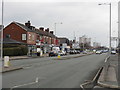
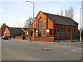
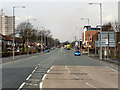


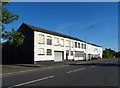
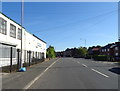


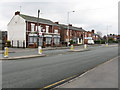


27 photos from this area
Area Information
Key information about the M40 5RT including its size, population, and administrative classification.
- Area Type
- Postcode
- Area Size
- 1.6 hectares
- Population
- 1929
- Population Density
- 121239 people/km²
House Prices in M40 5RT
8
Properties
£131,988
Average Sold Price
£54,950
Lowest Price
£295,000
Highest Price
Showing 8 properties
| Address | Type | Beds | Baths | Last Sale Price | Last Sale Date | |
|---|---|---|---|---|---|---|
| 845 Moston Lane, Manchester, M40 5RT | Bungalow | 3 | 3 | £295,000 | Aug 2024 | |
| 833 Moston Lane, Manchester, M40 5RT | Terraced | 2 | 1 | £90,000 | Apr 2020 | |
| 843 Moston Lane, Manchester, M40 5RT | Bungalow | - | - | £88,000 | Jan 2016 | |
| 831 Moston Lane, Manchester, M40 5RT | house | 3 | - | £54,950 | Mar 2014 | |
| 835 Moston Lane, Manchester, M40 5RT | Terraced | - | - | - | - | |
| 837 Moston Lane, Manchester, M40 5RT | Terraced | - | - | - | - | |
| Unit 3, Chain Bar Mill, 809 Moston Lane, Manchester, M40 5RT | Industrial | - | - | - | - | |
| Unit 7, Chain Bar Mill, 809 Moston Lane, Manchester, M40 5RT | Industrial | - | - | - | - |
Energy Efficiency in M40 5RT
Amenities
Schools
| Rank | School | Type | Entry gender | Ages |
|---|
Explore more schools in this area
Go to Schools tabDemographics
Household Size
Family (3-5 people)
most common
Accommodation Type
Houses
most common
Tenure
46
majority
Ethnic Group
White
most common
Religion
N/A
most common
Household Composition
N/A
most common
Age
47
median
Adults (30-64 years)
most common
Household Deprivation
N/A
with no deprivation
NS-SEC
19
in Lower managerial occupations
Explore more demographic insights in this area
Go to Demographics tabPlanning
Planning Constraints
- Flood RiskPremium
- Ramsar Wetland SitesPremium
- Area of Outstanding Natural BeautyPremium
- Protected Nature ReservePremium
- Protected WoodlandPremium