Area Overview for M40 2EL
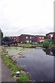
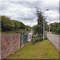
Photos of M40 2EL


Area Information
Living in M40 2EL means being part of a small, tightly knit residential cluster in England, home to 1,786 residents. The area’s compact nature fosters a sense of familiarity, with a population skewed toward adults aged 30–64. Daily life here is shaped by proximity to local amenities and schools, though the area’s size means it is not densely populated. The community is predominantly White, with a median age of 47, suggesting a mature demographic. While the area lacks large-scale infrastructure, its quiet, residential character appeals to those seeking stability. Residents benefit from strong digital connectivity and transport links, though the high crime risk requires caution. M40 2EL is not a sprawling suburb but a focused cluster, ideal for those prioritising convenience over expansive space.
- Area Type
- Postcode
- Area Size
- Not available
- Population
- 1786
- Population Density
- 7133 people/km²
The property market in M40 2EL is defined by low home ownership (29%) and a focus on houses rather than flats. This suggests a rental-dominated market, with fewer owner-occupied properties. The prevalence of houses may indicate a preference for family homes, though the small area size limits housing diversity. Buyers should consider the area’s compact nature, which may restrict options for larger properties. The low home ownership rate could reflect affordability challenges or a transient population. For those seeking to buy, the market may offer fewer choices, but the emphasis on houses could suit families prioritising space. The area’s small footprint means buyers must weigh proximity to amenities against limited property availability.
House Prices in M40 2EL
No properties found in this postcode.
Energy Efficiency in M40 2EL
The lifestyle in M40 2EL is shaped by nearby amenities, including five retail outlets such as Iceland Newton, Lidl Newton, and Farmfoods Newton, offering everyday shopping needs. Transport hubs like Newton Heath & Moston Metro Station and Ashburys Railway Station provide easy access to urban centres. The area’s proximity to multiple rail and metro stops enhances mobility, while the single bus coach station at Chorlton Street adds flexibility. These amenities contribute to a practical, convenience-driven lifestyle. Though the area is small, the variety of shops and transport options ensures residents can meet daily needs without long journeys. The mix of retail and transport infrastructure supports a balanced, accessible way of life.
Amenities
Schools
Residents of M40 2EL have access to a range of educational institutions, including Briscoe Lane Primary School and Briscoe Lane Infants’ School, both catering to younger children. The Briscoe Lane Academy, rated 'good' by Ofsted, provides secondary education. This mix of primary and academy schools offers families a structured educational pathway. The presence of multiple schools within the area suggests a focus on local schooling, reducing the need for long commutes. Families with children benefit from a variety of options, though the specific quality of education would depend on individual school performance. The schools’ proximity to homes enhances convenience for parents and students alike.
| Rank | School | Type | Entry gender | Ages |
|---|
Explore more schools in this area
Go to Schools tabDemographics
The community in M40 2EL is predominantly composed of adults aged 30–64, with a median age of 47. Home ownership here is relatively low at 29%, indicating a higher proportion of rental properties. The area is characterised by houses rather than flats, reflecting a traditional housing stock. The predominant ethnic group is White, with no data suggesting significant diversity beyond this. The age profile suggests a stable, mature population, which may influence local services and amenities. With 29% of residents owning their homes, the area may appeal more to renters or those seeking long-term leases. The demographic profile indicates a community that values established living over rapid change.
Household Size
Accommodation Type
Tenure
Ethnic Group
Religion
Household Composition
Age
Household Deprivation
NS-SEC
Explore more demographic insights in this area
Go to Demographics tabPlanning
Planning Constraints
- Flood RiskPremium
- Ramsar Wetland SitesPremium
- Area of Outstanding Natural BeautyPremium
- Protected Nature ReservePremium
- Protected WoodlandPremium