Area Overview for M40 0JF
Photos of M40 0JF

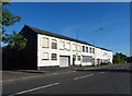
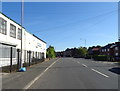
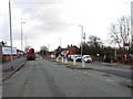
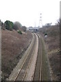
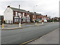

27 photos from this area
Area Information
Key information about the M40 0JF including its size, population, and administrative classification.
- Area Type
- Postcode
- Area Size
- 1.4 hectares
- Population
- 1678
- Population Density
- 5597 people/km²
House Prices in M40 0JF
33
Properties
£133,917
Average Sold Price
£35,150
Lowest Price
£237,000
Highest Price
Showing 33 properties
| Address | Type | Beds | Baths | Last Sale Price | Last Sale Date | |
|---|---|---|---|---|---|---|
| 15 St Margarets Road, Manchester, M40 0JF | Semi-detached | 3 | 1 | £236,000 | Mar 2025 | |
| 19 St Margarets Road, Manchester, M40 0JF | Semi-detached | 3 | 1 | £230,000 | Jan 2025 | |
| 5 St Margarets Road, Manchester, M40 0JF | Detached | 2 | 1 | £190,000 | Apr 2024 | |
| 9 St Margarets Road, Manchester, M40 0JF | Semi-detached | 3 | 1 | £225,000 | Feb 2024 | |
| 39 St Margarets Road, Manchester, M40 0JF | Semi-detached | 3 | 1 | £237,000 | Apr 2023 | |
| 3 St Margarets Road, Manchester, M40 0JF | house | 3 | - | £171,000 | May 2022 | |
| 11 St Margarets Road, Manchester, M40 0JF | house | - | - | £187,950 | Dec 2021 | |
| 35 St Margarets Road, Manchester, M40 0JF | house | - | - | £125,000 | Apr 2021 | |
| 29 St Margarets Road, Manchester, M40 0JF | house | - | - | £155,000 | Nov 2020 | |
| 23 St Margarets Road, Manchester, M40 0JF | house | - | - | £150,000 | Nov 2018 |
Page 1 of 4
Energy Efficiency in M40 0JF
Amenities
Schools
| Rank | School | Type | Entry gender | Ages |
|---|
Explore more schools in this area
Go to Schools tabDemographics
Household Size
Family (3-5 people)
most common
Accommodation Type
Houses
most common
Tenure
43
majority
Ethnic Group
White
most common
Religion
N/A
most common
Household Composition
N/A
most common
Age
47
median
Adults (30-64 years)
most common
Household Deprivation
N/A
with no deprivation
NS-SEC
19
in Lower managerial occupations
Explore more demographic insights in this area
Go to Demographics tabPlanning
Planning Constraints
- Flood RiskPremium
- Ramsar Wetland SitesPremium
- Area of Outstanding Natural BeautyPremium
- Protected Nature ReservePremium
- Protected WoodlandPremium