Area Overview for M4 5BB
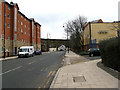
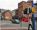
Photos of M4 5BB


Area Information
Living in M4 5BB means being part of a small, tightly knit residential cluster in England, home to 1,391 people. This area is characterised by its compact size and proximity to urban hubs, with a population skewed heavily towards young adults aged 15–29. The community thrives on accessibility, with multiple rail stations, metro stops, and retail outlets within easy reach. Daily life here is shaped by the presence of nearby amenities such as Aldi Urban, M&S Urban, and Co-op Ancoats, offering convenience for shopping and dining. The area’s transport links are robust, with five rail stations including Manchester Oxford Road and Ardwick, and metro stations like Piccadilly Gardens and Market Street. Despite its small footprint, M4 5BB provides a blend of practicality and connectivity, making it a viable choice for those prioritising proximity to city services and public transport. However, the low home ownership rate and prevalence of flats suggest a rental-focused market, which may influence long-term investment considerations.
- Area Type
- Postcode
- Area Size
- Not available
- Population
- 1391
- Population Density
- 12892 people/km²
The property market in M4 5BB is defined by a low home ownership rate of 23%, with flats comprising the majority of housing stock. This indicates a rental-centric environment, where ownership is less common than tenancy. The small area’s limited size means the housing stock is concentrated, with few opportunities for expansion or new developments. For buyers, this suggests a niche market where properties are likely to be older, smaller, or part of shared ownership schemes. The prevalence of flats may appeal to those seeking low-maintenance living, but it also means competition for available owner-occupied homes. Nearby areas may offer similar housing profiles, though specific details about surrounding zones are not included. Investors or buyers should consider the area’s transient nature and the potential for long-term rental demand from young professionals and students.
House Prices in M4 5BB
Showing 4 properties
| Address | Type | Beds | Baths | Last Sale Price | Last Sale Date | |
|---|---|---|---|---|---|---|
| Flat 1, 2 Cross Keys Street, Manchester, M4 5BB | Flat | 1 | 1 | - | - | |
| Flat 3, 2 Cross Keys Street, Manchester, M4 5BB | hotel | - | - | - | - | |
| Flat 4, 2 Cross Keys Street, Manchester, M4 5BB | hotel | - | - | - | - | |
| Flat 2, 2 Cross Keys Street, Manchester, M4 5BB | Flat | - | - | - | - |
Energy Efficiency in M4 5BB
Residents of M4 5BB have access to a range of amenities within practical reach, enhancing daily life. Retail options include Aldi Urban, M&S Urban, and Co-op Ancoats, offering convenience for grocery shopping and casual dining. The area’s proximity to Piccadilly Gardens, Market Street, and New Islington provides leisure opportunities, from green spaces to urban shopping. Rail stations like Manchester Oxford Road and Ardwick connect to cultural and professional centres, while the Chorlton Street Coach Station ensures local mobility. The mix of retail, transport, and public spaces creates a dynamic environment, though the small area means residents must venture slightly further for more specialised services. The balance of convenience and connectivity makes M4 5BB appealing for those who prioritise accessibility over expansive local amenities.
Amenities
Schools
| Rank | School | Type | Entry gender | Ages |
|---|
Explore more schools in this area
Go to Schools tabDemographics
The population of M4 5BB is overwhelmingly young, with a median age of 22 and the most common age range being 15–29 years. This demographic profile indicates a community dominated by students, young professionals, and recent graduates. Only 23% of residents own their homes, with flats being the predominant accommodation type. This suggests a rental market that caters to transient or budget-conscious residents. The predominant ethnic group is White, though no specific data on diversity or deprivation is provided. The low home ownership rate may reflect the area’s role as a transitional or short-term living space, with residents potentially prioritising affordability and convenience over long-term stability. The absence of detailed diversity metrics means the community’s social composition remains largely unexplored in the data.
Household Size
Accommodation Type
Tenure
Ethnic Group
Religion
Household Composition
Age
Household Deprivation
NS-SEC
Explore more demographic insights in this area
Go to Demographics tabPlanning
Planning Constraints
- Flood RiskPremium
- Ramsar Wetland SitesPremium
- Area of Outstanding Natural BeautyPremium
- Protected Nature ReservePremium
- Protected WoodlandPremium