Area Overview for M38 9QB
Photos of M38 9QB
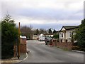
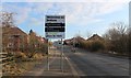
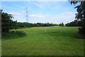
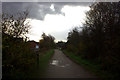
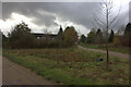
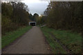

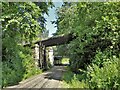
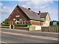
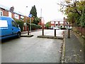
23 photos from this area
Area Information
Key information about the M38 9QB including its size, population, and administrative classification.
- Area Type
- Postcode
- Area Size
- 7506 m²
- Population
- 1746
- Population Density
- 5320 people/km²
House Prices in M38 9QB
29
Properties
£107,523
Average Sold Price
£38,500
Lowest Price
£191,250
Highest Price
Showing 29 properties
| Address | Type | Beds | Baths | Last Sale Price | Last Sale Date | |
|---|---|---|---|---|---|---|
| 52 Trafford Drive, Little Hulton, Worsley, M38 9QB | Terraced | 3 | 1 | £163,000 | May 2025 | |
| 44 Trafford Drive, Little Hulton, Worsley, M38 9QB | Terraced | 3 | 1 | £191,250 | Dec 2024 | |
| 56 Trafford Drive, Little Hulton, Worsley, M38 9QB | house | 2 | 1 | £155,500 | Feb 2023 | |
| 34 Trafford Drive, Little Hulton, Worsley, M38 9QB | house | 3 | 1 | £117,500 | Apr 2022 | |
| 32 Trafford Drive, Little Hulton, Worsley, M38 9QB | Terraced | 3 | 1 | £101,000 | Dec 2020 | |
| 58 Trafford Drive, Little Hulton, Worsley, M38 9QB | Terraced | 3 | 1 | £115,000 | Aug 2019 | |
| 48 Trafford Drive, Little Hulton, Worsley, M38 9QB | Terraced | 2 | 1 | £96,000 | Dec 2018 | |
| 42 Trafford Drive, Little Hulton, Worsley, M38 9QB | Terraced | 2 | 1 | £70,000 | Apr 2015 | |
| 26 Trafford Drive, Little Hulton, Worsley, M38 9QB | house | - | - | £60,000 | Nov 2009 | |
| 50 Trafford Drive, Little Hulton, Worsley, M38 9QB | Semi-detached | 2 | 1 | £75,000 | Sep 2008 |
Page 1 of 3
Energy Efficiency in M38 9QB
Amenities
Schools
| Rank | School | Type | Entry gender | Ages |
|---|
Explore more schools in this area
Go to Schools tabDemographics
Household Size
One person
most common
Accommodation Type
Houses
most common
Tenure
32
majority
Ethnic Group
White
most common
Religion
N/A
most common
Household Composition
N/A
most common
Age
47
median
Adults (30-64 years)
most common
Household Deprivation
N/A
with no deprivation
NS-SEC
13
in Lower managerial occupations
Explore more demographic insights in this area
Go to Demographics tabPlanning
Planning Constraints
- Flood RiskPremium
- Ramsar Wetland SitesPremium
- Area of Outstanding Natural BeautyPremium
- Protected Nature ReservePremium
- Protected WoodlandPremium