Area Overview for M35 9WJ
Photos of M35 9WJ

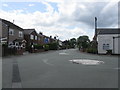

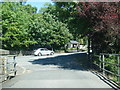
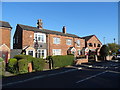

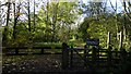
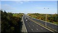

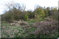
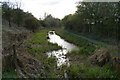

45 photos from this area
Area Information
Key information about the M35 9WJ including its size, population, and administrative classification.
- Area Type
- Postcode
- Area Size
- 31.8 hectares
- Population
- 1377
- Population Density
- 1337 people/km²
House Prices in M35 9WJ
17
Properties
£341,333
Average Sold Price
£99,000
Lowest Price
£715,000
Highest Price
Showing 17 properties
| Address | Type | Beds | Baths | Last Sale Price | Last Sale Date | |
|---|---|---|---|---|---|---|
| Boodle Fold Farm, Stannybrook Road, Failsworth, M35 9WJ | Detached | 4 | 1 | £715,000 | Jan 2019 | |
| Red Bills, Stannybrook Road, Failsworth, M35 9WJ | Detached | - | - | £210,000 | Apr 2011 | |
| Oakhill House, Stannybrook Road, Failsworth, M35 9WJ | house | - | - | £99,000 | Dec 2001 | |
| 1, Oakhill Cottage, Stannybrook Road, Failsworth, M35 9WJ | Semi-detached | 4 | 4 | - | - | |
| The Barn, Medlock Hall, Stannybrook Road, Failsworth, M35 9WJ | Semi-detached | 4 | 1 | - | - | |
| The Flat, Daisy Nook Farm, Stannybrook Road, Failsworth, M35 9WJ | Flat | 4 | 4 | - | - | |
| Daisy Nook Garden Centre Ltd, Daisy Nook Garden Centre, Stannybrook Road, Failsworth, M35 9WJ | retail_financial | - | - | - | - | |
| The Chalet At The Stable, Stannybrook Road, Failsworth, M35 9WJ | Detached | - | - | - | - | |
| Oakhill Cottage, Stannybrook Road, Failsworth, M35 9WJ | Semi-detached | - | - | - | - | |
| Owd Abs Daisy Nook Farm, Stannybrook Road, Failsworth, M35 9WJ | Farm | - | - | - | - |
Page 1 of 2
Energy Efficiency in M35 9WJ
Amenities
Schools
| Rank | School | Type | Entry gender | Ages |
|---|
Explore more schools in this area
Go to Schools tabDemographics
Household Size
Two person
most common
Accommodation Type
Houses
most common
Tenure
85
majority
Ethnic Group
White
most common
Religion
N/A
most common
Household Composition
N/A
most common
Age
47
median
Adults (30-64 years)
most common
Household Deprivation
N/A
with no deprivation
NS-SEC
35
in Lower managerial occupations
Explore more demographic insights in this area
Go to Demographics tabPlanning
Planning Constraints
- Flood RiskPremium
- Ramsar Wetland SitesPremium
- Area of Outstanding Natural BeautyPremium
- Protected Nature ReservePremium
- Protected WoodlandPremium