Area Overview for M35 9QF
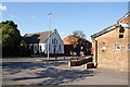
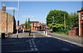
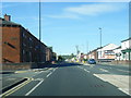
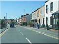
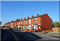
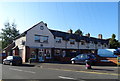
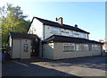
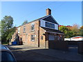
Photos of M35 9QF


Area Information
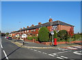
Living in M35 9QF means inhabiting a small, tightly knit residential cluster in England with a population of 1,584. This area is characterised by its compact size and focus on housing, with most properties being standalone homes. The community here is predominantly composed of adults aged 30–64, suggesting a stable, established demographic. Daily life is shaped by proximity to essential services, including retail outlets like Morrisons, Aldi, and Tesco, and transport links to nearby towns such as Failsworth and South Chadderton. While the area lacks natural features like AONBs or protected woodlands, its low flood risk and absence of planning constraints make it a practical choice for those prioritising safety and ease of development. The high home ownership rate of 85% indicates a long-term presence of residents, though the small population means the area is more of a satellite hub than a standalone town. For those seeking a quiet, functional neighbourhood with access to urban amenities, M35 9QF offers a balance of residential comfort and practical connectivity.
- Area Type
- Postcode
- Area Size
- Not available
- Population
- 1584
- Population Density
- 6511 people/km²
The property market in M35 9QF is defined by high home ownership (85%) and a predominance of houses. This suggests a market skewed towards owner-occupied properties rather than rentals, which may limit availability for buyers seeking short-term or flexible housing. The concentration of houses, rather than flats or apartments, indicates a preference for larger, more private living spaces, which could appeal to families or individuals prioritising space. However, the small population and compact nature of the area mean the housing stock is likely limited, with buyers potentially needing to look beyond M35 9QF for more options. The high home ownership rate also implies a stable market with fewer properties coming up for sale, which could affect both pricing and availability. For those considering the area, the focus on houses may align with a desire for traditional, long-term residential properties but may not suit those needing smaller or more modern housing solutions.
House Prices in M35 9QF
No properties found in this postcode.
Energy Efficiency in M35 9QF
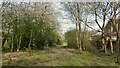
The lifestyle in M35 9QF is shaped by its proximity to a range of amenities within practical reach. Residents can access major retail chains such as Morrisons Daily Failsworth 650, Aldi Failsworth, and Tesco Failsworth, offering everyday shopping needs. The area’s transport links to metro, rail, and bus services facilitate both local and regional travel, connecting residents to nearby towns like Failsworth and South Chadderton. While the data does not mention parks or leisure facilities, the absence of planning constraints related to natural areas suggests opportunities for outdoor activities in surrounding regions. The convenience of nearby retail and transport hubs contributes to a functional, accessible daily life. For those prioritising practicality over expansive leisure options, M35 9QF provides a straightforward, service-oriented environment. The compact nature of the area means residents are likely to rely on nearby towns for more extensive amenities, but the immediate vicinity offers sufficient resources for daily living.
Amenities
Schools
Residents of M35 9QF have access to two primary schools: Stansfield Road Junior School and Stansfield Road Infant and Nursery School. Both institutions cater to younger children, covering early years through primary education. The presence of both junior and infant/nursery schools suggests a comprehensive provision for families with children of different ages, reducing the need to travel for schooling. However, the data does not include Ofsted ratings or academic performance metrics, so the quality of education cannot be assessed from this information alone. For families prioritising proximity to schools, the availability of two primary schools within the area is a practical advantage. The absence of secondary schools nearby may require residents to seek options in adjacent towns, which could impact commuting times for older children. The focus on primary education reflects the demographic profile of the area, which is skewed towards adults in their 30s to 60s, likely with school-age dependents.
| Rank | School | Type | Entry gender | Ages |
|---|
Explore more schools in this area
Go to Schools tabDemographics
The community in M35 9QF is predominantly composed of adults aged 30–64, with a median age of 47. This suggests a mature, settled population, likely with established careers and families. Home ownership is high at 85%, indicating a strong preference for long-term residency over rental properties. The area is largely composed of houses rather than flats, which aligns with the demographic profile of older, family-oriented residents. The predominant ethnic group is White, with no specific data on other groups provided. The absence of detailed diversity metrics means the area’s cultural composition remains largely unexplored in the data. The high home ownership rate and age profile suggest a community focused on stability and continuity, with limited turnover of residents. This can create a cohesive, familiar environment but may also limit the diversity of perspectives and experiences within the area.
Household Size
Accommodation Type
Tenure
Ethnic Group
Religion
Household Composition
Age
Household Deprivation
NS-SEC
Explore more demographic insights in this area
Go to Demographics tabPlanning
Planning Constraints
- Flood RiskPremium
- Ramsar Wetland SitesPremium
- Area of Outstanding Natural BeautyPremium
- Protected Nature ReservePremium
- Protected WoodlandPremium