Area Overview for M35 9LB
Photos of M35 9LB
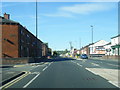
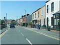
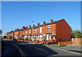
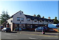
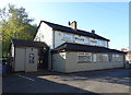
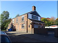
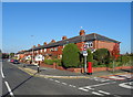
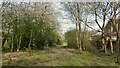
36 photos from this area
Area Information
Key information about the M35 9LB including its size, population, and administrative classification.
- Area Type
- Postcode
- Area Size
- 6988 m²
- Population
- 1584
- Population Density
- 6511 people/km²
House Prices in M35 9LB
30
Properties
£135,268
Average Sold Price
£47,000
Lowest Price
£236,250
Highest Price
Showing 30 properties
| Address | Type | Beds | Baths | Last Sale Price | Last Sale Date | |
|---|---|---|---|---|---|---|
| 53 Kew Road, Failsworth, M35 9LB | Semi-detached | 3 | 1 | £230,000 | Oct 2023 | |
| 13 Kew Road, Failsworth, M35 9LB | Semi-detached | 3 | 1 | £220,000 | Feb 2022 | |
| 9 Kew Road, Failsworth, M35 9LB | house | - | - | £236,250 | Sep 2021 | |
| 15 Kew Road, Failsworth, M35 9LB | house | - | - | £199,950 | Aug 2021 | |
| 41 Kew Road, Failsworth, M35 9LB | house | - | - | £165,000 | Feb 2021 | |
| 7 Kew Road, Failsworth, M35 9LB | house | - | - | £169,950 | Jan 2020 | |
| 17 Kew Road, Failsworth, M35 9LB | Semi-detached | 3 | 1 | £161,500 | Nov 2018 | |
| 47 Kew Road, Failsworth, M35 9LB | Semi-detached | - | - | £169,950 | Jun 2018 | |
| 51 Kew Road, Failsworth, M35 9LB | Semi-detached | 3 | 1 | £92,000 | Jan 2017 | |
| 25 Kew Road, Failsworth, M35 9LB | house | - | - | £132,500 | Jan 2017 |
Page 1 of 3
Energy Efficiency in M35 9LB
Amenities
Schools
| Rank | School | Type | Entry gender | Ages |
|---|
Explore more schools in this area
Go to Schools tabDemographics
Household Size
Two person
most common
Accommodation Type
Houses
most common
Tenure
85
majority
Ethnic Group
White
most common
Religion
N/A
most common
Household Composition
N/A
most common
Age
47
median
Adults (30-64 years)
most common
Household Deprivation
N/A
with no deprivation
NS-SEC
28
in Lower managerial occupations
Explore more demographic insights in this area
Go to Demographics tabPlanning
Planning Constraints
- Flood RiskPremium
- Ramsar Wetland SitesPremium
- Area of Outstanding Natural BeautyPremium
- Protected Nature ReservePremium
- Protected WoodlandPremium