Area Overview for M34 5ZP
Photos of M34 5ZP
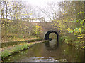
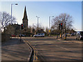
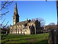
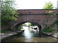

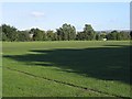
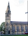
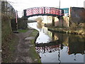
100 photos from this area
Area Information
Key information about the M34 5ZP including its size, population, and administrative classification.
- Area Type
- Postcode
- Area Size
- 4.6 hectares
- Population
- 1733
- Population Density
- 2945 people/km²
House Prices in M34 5ZP
52
Properties
£237,650
Average Sold Price
£127,995
Lowest Price
£435,000
Highest Price
Showing 52 properties
| Address | Type | Beds | Baths | Last Sale Price | Last Sale Date | |
|---|---|---|---|---|---|---|
| 3 Arnfield Road, Audenshaw, M34 5ZP | Retail | 3 | 2 | £271,000 | Jul 2025 | |
| 41 Arnfield Road, Audenshaw, M34 5ZP | Terraced | 3 | 3 | £283,000 | Jun 2025 | |
| 5 Arnfield Road, Audenshaw, M34 5ZP | house | - | - | £265,000 | Mar 2025 | |
| 29 Arnfield Road, Audenshaw, M34 5ZP | Terraced | 2 | 1 | £230,000 | Dec 2024 | |
| 23 Arnfield Road, Audenshaw, M34 5ZP | Semi-detached | 3 | 1 | £290,000 | Oct 2024 | |
| 83 Arnfield Road, Audenshaw, M34 5ZP | Detached | 4 | 3 | £435,000 | Sep 2024 | |
| 43 Arnfield Road, Audenshaw, M34 5ZP | Terraced | 3 | 2 | £260,000 | Apr 2024 | |
| 15 Arnfield Road, Audenshaw, M34 5ZP | house | - | - | £345,000 | Dec 2023 | |
| 93 Arnfield Road, Audenshaw, M34 5ZP | Flat | - | - | £153,000 | Dec 2023 | |
| 89 Arnfield Road, Audenshaw, M34 5ZP | Flat | - | - | £157,250 | Sep 2023 |
Page 1 of 6
Energy Efficiency in M34 5ZP
Amenities
Schools
| Rank | School | Type | Entry gender | Ages |
|---|
Explore more schools in this area
Go to Schools tabDemographics
Household Size
Two person
most common
Accommodation Type
Houses
most common
Tenure
56
majority
Ethnic Group
White
most common
Religion
N/A
most common
Household Composition
N/A
most common
Age
47
median
Adults (30-64 years)
most common
Household Deprivation
N/A
with no deprivation
NS-SEC
26
in Lower managerial occupations
Explore more demographic insights in this area
Go to Demographics tabPlanning
Planning Constraints
- Flood RiskPremium
- Ramsar Wetland SitesPremium
- Area of Outstanding Natural BeautyPremium
- Protected Nature ReservePremium
- Protected WoodlandPremium