Area Overview for M34 3RW
Photos of M34 3RW
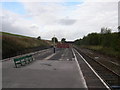
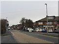
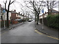
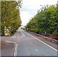

97 photos from this area
Area Information
Key information about the M34 3RW including its size, population, and administrative classification.
- Area Type
- Postcode
- Area Size
- 8839 m²
- Population
- 1210
- Population Density
- 2363 people/km²
House Prices in M34 3RW
37
Properties
£79,098
Average Sold Price
£20,000
Lowest Price
£182,000
Highest Price
Showing 37 properties
| Address | Type | Beds | Baths | Last Sale Price | Last Sale Date | |
|---|---|---|---|---|---|---|
| 31 Seymour Street, Denton, M34 3RW | Terraced | 2 | 1 | £170,000 | Sep 2024 | |
| 28 Seymour Street, Denton, M34 3RW | Terraced | 3 | 1 | £177,000 | Jul 2024 | |
| 27 Seymour Street, Denton, M34 3RW | Terraced | 2 | 1 | £120,500 | Jun 2020 | |
| 11 Seymour Street, Denton, M34 3RW | Terraced | 2 | 1 | £90,000 | Mar 2020 | |
| 32 Seymour Street, Denton, M34 3RW | Terraced | 3 | 1 | £77,000 | Jan 2019 | |
| 13 Seymour Street, Denton, M34 3RW | Terraced | 2 | 1 | £69,000 | Aug 2017 | |
| 34 Seymour Street, Denton, M34 3RW | Terraced | 4 | 1 | £182,000 | Feb 2017 | |
| 29 Seymour Street, Denton, M34 3RW | Terraced | 2 | 1 | £93,000 | Jan 2017 | |
| 14 Seymour Street, Denton, M34 3RW | Terraced | 2 | 1 | £52,000 | Mar 2014 | |
| 25 Seymour Street, Denton, M34 3RW | house | - | - | £62,000 | May 2013 |
Page 1 of 4
Energy Efficiency in M34 3RW
Amenities
Schools
| Rank | School | Type | Entry gender | Ages |
|---|
Explore more schools in this area
Go to Schools tabDemographics
Household Size
One person
most common
Accommodation Type
Houses
most common
Tenure
60
majority
Ethnic Group
White
most common
Religion
N/A
most common
Household Composition
N/A
most common
Age
47
median
Adults (30-64 years)
most common
Household Deprivation
N/A
with no deprivation
NS-SEC
24
in Lower managerial occupations
Explore more demographic insights in this area
Go to Demographics tabPlanning
Planning Constraints
- Flood RiskPremium
- Ramsar Wetland SitesPremium
- Area of Outstanding Natural BeautyPremium
- Protected Nature ReservePremium
- Protected WoodlandPremium