Area Overview for M34 3EF
Photos of M34 3EF
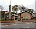
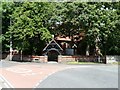
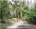
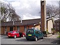
100 photos from this area
Area Information
Key information about the M34 3EF including its size, population, and administrative classification.
- Area Type
- Postcode
- Area Size
- 13.9 hectares
- Population
- 1367
- Population Density
- 2208 people/km²
House Prices in M34 3EF
40
Properties
£183,580
Average Sold Price
£66,750
Lowest Price
£308,000
Highest Price
Showing 40 properties
| Address | Type | Beds | Baths | Last Sale Price | Last Sale Date | |
|---|---|---|---|---|---|---|
| 66 Nasmyth Avenue, Denton, M34 3EF | Bungalow | 3 | 2 | £308,000 | Oct 2024 | |
| 70 Nasmyth Avenue, Denton, M34 3EF | house | - | - | £220,000 | Dec 2023 | |
| 116 Nasmyth Avenue, Denton, M34 3EF | Bungalow | - | - | £300,000 | Mar 2021 | |
| 72 Nasmyth Avenue, Denton, M34 3EF | Semi-detached | 2 | 1 | £202,000 | Apr 2019 | |
| 76 Nasmyth Avenue, Denton, M34 3EF | Semi-detached | 3 | - | £165,000 | Oct 2017 | |
| 44 Nasmyth Avenue, Denton, M34 3EF | Detached | 5 | 1 | £279,000 | Dec 2016 | |
| 108 Nasmyth Avenue, Denton, M34 3EF | Semi-detached | 3 | - | £190,000 | Dec 2016 | |
| 42 Nasmyth Avenue, Denton, M34 3EF | Detached | 4 | 2 | £280,000 | Oct 2015 | |
| 110 Nasmyth Avenue, Denton, M34 3EF | house | 3 | - | £180,000 | Feb 2015 | |
| 78 Nasmyth Avenue, Denton, M34 3EF | house | - | - | £130,000 | Oct 2013 |
Page 1 of 4
Energy Efficiency in M34 3EF
Amenities
Schools
| Rank | School | Type | Entry gender | Ages |
|---|
Explore more schools in this area
Go to Schools tabDemographics
Household Size
Two person
most common
Accommodation Type
Houses
most common
Tenure
84
majority
Ethnic Group
White
most common
Religion
N/A
most common
Household Composition
N/A
most common
Age
47
median
Adults (30-64 years)
most common
Household Deprivation
N/A
with no deprivation
NS-SEC
29
in Lower managerial occupations
Explore more demographic insights in this area
Go to Demographics tabPlanning
Planning Constraints
- Flood RiskPremium
- Ramsar Wetland SitesPremium
- Area of Outstanding Natural BeautyPremium
- Protected Nature ReservePremium
- Protected WoodlandPremium