Area Overview for M33 7TL
Photos of M33 7TL
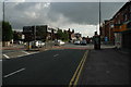
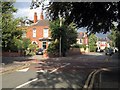
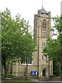

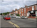


100 photos from this area
Area Information
Key information about the M33 7TL including its size, population, and administrative classification.
- Area Type
- Postcode
- Area Size
- 1315 m²
- Population
- 1832
- Population Density
- 7082 people/km²
House Prices in M33 7TL
9
Properties
£229,088
Average Sold Price
£74,000
Lowest Price
£365,000
Highest Price
Showing 9 properties
| Address | Type | Beds | Baths | Last Sale Price | Last Sale Date | |
|---|---|---|---|---|---|---|
| 12 Holly Drive, Sale, M33 7TL | Terraced | 2 | 1 | £365,000 | Jan 2025 | |
| 16 Holly Drive, Sale, M33 7TL | Terraced | 3 | 1 | £322,000 | Oct 2024 | |
| 8 Holly Drive, Sale, M33 7TL | Terraced | 1 | 1 | £257,500 | Sep 2022 | |
| 10 Holly Drive, Sale, M33 7TL | Terraced | 2 | - | £245,000 | Jul 2021 | |
| 6 Holly Drive, Sale, M33 7TL | Terraced | 2 | - | £238,000 | Feb 2020 | |
| 18 Holly Drive, Sale, M33 7TL | Terraced | - | - | £150,000 | Jun 2008 | |
| 14 Holly Drive, Sale, M33 7TL | Terraced | 2 | 1 | £181,200 | Jan 2007 | |
| 20 Holly Drive, Sale, M33 7TL | Terraced | - | - | £74,000 | Sep 1999 | |
| 2 Holly Drive, Sale, M33 7TL | Terraced | 2 | - | - | - |
Energy Efficiency in M33 7TL
Amenities
Schools
| Rank | School | Type | Entry gender | Ages |
|---|
Explore more schools in this area
Go to Schools tabDemographics
Household Size
Two person
most common
Accommodation Type
Houses
most common
Tenure
65
majority
Ethnic Group
White
most common
Religion
N/A
most common
Household Composition
N/A
most common
Age
47
median
Adults (30-64 years)
most common
Household Deprivation
N/A
with no deprivation
NS-SEC
55
in Lower managerial occupations
Explore more demographic insights in this area
Go to Demographics tabPlanning
Planning Constraints
- Flood RiskPremium
- Ramsar Wetland SitesPremium
- Area of Outstanding Natural BeautyPremium
- Protected Nature ReservePremium
- Protected WoodlandPremium