Area Overview for M33 4XW
Photos of M33 4XW

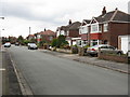
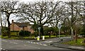
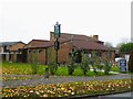
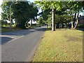
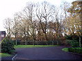
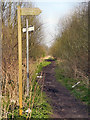
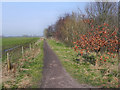
16 photos from this area
Area Information
Key information about the M33 4XW including its size, population, and administrative classification.
- Area Type
- Postcode
- Area Size
- 1.1 hectares
- Population
- 1579
- Population Density
- 5947 people/km²
House Prices in M33 4XW
37
Properties
£68,682
Average Sold Price
£12,500
Lowest Price
£255,000
Highest Price
Showing 37 properties
| Address | Type | Beds | Baths | Last Sale Price | Last Sale Date | |
|---|---|---|---|---|---|---|
| 5 Aldworth Grove, Sale, M33 4XW | Flat | 2 | 1 | £75,000 | Aug 2025 | |
| 42 Aldworth Grove, Sale, M33 4XW | Semi-detached | 2 | 1 | £255,000 | Jun 2024 | |
| 7 Aldworth Grove, Sale, M33 4XW | Maisonette | - | - | £84,375 | Oct 2016 | |
| 17 Aldworth Grove, Sale, M33 4XW | Flat | 2 | - | £105,000 | Oct 2015 | |
| 11 Aldworth Grove, Sale, M33 4XW | Flat | - | - | £24,500 | Aug 2015 | |
| 3 Aldworth Grove, Sale, M33 4XW | house | - | - | £57,500 | Sep 2011 | |
| 19 Aldworth Grove, Sale, M33 4XW | Maisonette | - | - | £23,125 | Sep 2011 | |
| 13 Aldworth Grove, Sale, M33 4XW | Flat | - | - | £43,000 | Nov 2010 | |
| 15 Aldworth Grove, Sale, M33 4XW | Flat | - | - | £52,000 | Jan 2006 | |
| 40 Aldworth Grove, Sale, M33 4XW | Semi-detached | - | - | £12,500 | Nov 1997 |
Page 1 of 4
Energy Efficiency in M33 4XW
Amenities
Schools
| Rank | School | Type | Entry gender | Ages |
|---|
Explore more schools in this area
Go to Schools tabDemographics
Household Size
One person
most common
Accommodation Type
Houses
most common
Tenure
32
majority
Ethnic Group
White
most common
Religion
N/A
most common
Household Composition
N/A
most common
Age
47
median
Adults (30-64 years)
most common
Household Deprivation
N/A
with no deprivation
NS-SEC
24
in Lower managerial occupations
Explore more demographic insights in this area
Go to Demographics tabPlanning
Planning Constraints
- Flood RiskPremium
- Ramsar Wetland SitesPremium
- Area of Outstanding Natural BeautyPremium
- Protected Nature ReservePremium
- Protected WoodlandPremium