Area Overview for M33 4GJ
Photos of M33 4GJ

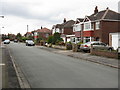
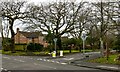
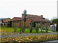
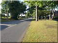
16 photos from this area
Area Information
Key information about the M33 4GJ including its size, population, and administrative classification.
- Area Type
- Postcode
- Area Size
- 1.3 hectares
- Population
- 1812
- Population Density
- 5196 people/km²
House Prices in M33 4GJ
53
Properties
£142,800
Average Sold Price
£54,000
Lowest Price
£285,000
Highest Price
Showing 53 properties
| Address | Type | Beds | Baths | Last Sale Price | Last Sale Date | |
|---|---|---|---|---|---|---|
| 96 Thirsk Avenue, Sale, M33 4GJ | Terraced | 3 | 1 | £185,000 | Oct 2024 | |
| 18 Thirsk Avenue, Sale, M33 4GJ | Flat | - | - | £106,000 | Dec 2023 | |
| 82 Thirsk Avenue, Sale, M33 4GJ | Terraced | 3 | 1 | £285,000 | Jun 2023 | |
| 32 Thirsk Avenue, Sale, M33 4GJ | house | - | - | £210,000 | Dec 2020 | |
| 26 Thirsk Avenue, Sale, M33 4GJ | house | - | - | £132,000 | Aug 2019 | |
| 56 Thirsk Avenue, Sale, M33 4GJ | house | - | - | £130,000 | Aug 2018 | |
| 88 Thirsk Avenue, Sale, M33 4GJ | Terraced | 3 | 1 | £147,000 | Jun 2018 | |
| 58 Thirsk Avenue, Sale, M33 4GJ | house | 3 | - | £110,000 | Jun 2011 | |
| 24 Thirsk Avenue, Sale, M33 4GJ | Flat | - | - | £69,000 | Oct 2004 | |
| 66 Thirsk Avenue, Sale, M33 4GJ | Terraced | 3 | 1 | £54,000 | Jan 2004 |
Page 1 of 6
Energy Efficiency in M33 4GJ
Amenities
Schools
| Rank | School | Type | Entry gender | Ages |
|---|
Explore more schools in this area
Go to Schools tabDemographics
Household Size
Family (3-5 people)
most common
Accommodation Type
Houses
most common
Tenure
27
majority
Ethnic Group
White
most common
Religion
N/A
most common
Household Composition
N/A
most common
Age
47
median
Adults (30-64 years)
most common
Household Deprivation
N/A
with no deprivation
NS-SEC
20
in Lower managerial occupations
Explore more demographic insights in this area
Go to Demographics tabPlanning
Planning Constraints
- Flood RiskPremium
- Ramsar Wetland SitesPremium
- Area of Outstanding Natural BeautyPremium
- Protected Nature ReservePremium
- Protected WoodlandPremium