Area Overview for M33 3LD
Photos of M33 3LD


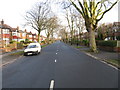
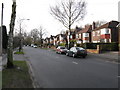
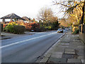
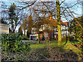
10 photos from this area
Area Information
Key information about the M33 3LD including its size, population, and administrative classification.
- Area Type
- Postcode
- Area Size
- 8215 m²
- Population
- 1404
- Population Density
- 5600 people/km²
House Prices in M33 3LD
20
Properties
£258,187
Average Sold Price
£800
Lowest Price
£475,000
Highest Price
Showing 20 properties
| Address | Type | Beds | Baths | Last Sale Price | Last Sale Date | |
|---|---|---|---|---|---|---|
| 9 Dalebrook Road, Sale, M33 3LD | house | - | - | £475,000 | Feb 2022 | |
| 29 Dalebrook Road, Sale, M33 3LD | house | - | - | £415,000 | Mar 2021 | |
| 11 Dalebrook Road, Sale, M33 3LD | house | - | - | £800 | Feb 2019 | |
| 19 Dalebrook Road, Sale, M33 3LD | house | - | - | £405,000 | Dec 2017 | |
| 25 Dalebrook Road, Sale, M33 3LD | Detached | 3 | 1 | £345,000 | Aug 2016 | |
| 15 Dalebrook Road, Sale, M33 3LD | Detached | 3 | 1 | £290,000 | May 2015 | |
| 33 Dalebrook Road, Sale, M33 3LD | house | - | - | £310,000 | Apr 2014 | |
| 7 Dalebrook Road, Sale, M33 3LD | house | - | - | £320,000 | Oct 2013 | |
| 35 Dalebrook Road, Sale, M33 3LD | house | - | - | £250,000 | May 2010 | |
| 23 Dalebrook Road, Sale, M33 3LD | Detached | - | - | £249,000 | Nov 2006 |
Page 1 of 2
Energy Efficiency in M33 3LD
Amenities
Schools
| Rank | School | Type | Entry gender | Ages |
|---|
Explore more schools in this area
Go to Schools tabDemographics
Household Size
Family (3-5 people)
most common
Accommodation Type
Houses
most common
Tenure
74
majority
Ethnic Group
White
most common
Religion
N/A
most common
Household Composition
N/A
most common
Age
47
median
Adults (30-64 years)
most common
Household Deprivation
N/A
with no deprivation
NS-SEC
46
in Lower managerial occupations
Explore more demographic insights in this area
Go to Demographics tabPlanning
Planning Constraints
- Flood RiskPremium
- Ramsar Wetland SitesPremium
- Area of Outstanding Natural BeautyPremium
- Protected Nature ReservePremium
- Protected WoodlandPremium