Area Overview for M33 2BH
Photos of M33 2BH

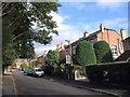
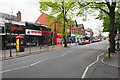
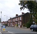
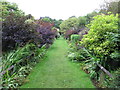

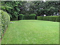


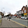
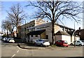
56 photos from this area
Area Information
Key information about the M33 2BH including its size, population, and administrative classification.
- Area Type
- Postcode
- Area Size
- 1.3 hectares
- Population
- 2158
- Population Density
- 4868 people/km²
House Prices in M33 2BH
72
Properties
£524,369
Average Sold Price
£284,000
Lowest Price
£890,000
Highest Price
Showing 72 properties
| Address | Type | Beds | Baths | Last Sale Price | Last Sale Date | |
|---|---|---|---|---|---|---|
| 16 Irlam Road, Sale, M33 2BH | Detached | 4 | 1 | £535,000 | May 2024 | |
| 21 Irlam Road, Sale, M33 2BH | Semi-detached | 6 | 2 | £890,000 | Oct 2022 | |
| 25 Irlam Road, Sale, M33 2BH | house | - | - | £795,000 | Sep 2021 | |
| 2A Irlam Road, Sale, M33 2BH | Detached | 4 | - | £760,000 | Mar 2020 | |
| 20 Irlam Road, Sale, M33 2BH | house | - | - | £284,000 | Jul 2015 | |
| 18 Irlam Road, Sale, M33 2BH | Semi-detached | 3 | - | £299,950 | Mar 2015 | |
| 21A Irlam Road, Sale, M33 2BH | Detached | 4 | - | £305,000 | Jun 2014 | |
| 14 Irlam Road, Sale, M33 2BH | house | - | - | £326,000 | May 2014 | |
| Flat 5, Glen Maye, 8 Irlam Road, Sale, M33 2BH | Flat | 2 | 1 | - | - | |
| Flat 2, 19 Irlam Road, Sale, M33 2BH | Flat | 2 | 1 | - | - |
Page 1 of 8
Energy Efficiency in M33 2BH
Amenities
Schools
| Rank | School | Type | Entry gender | Ages |
|---|
Explore more schools in this area
Go to Schools tabDemographics
Household Size
One person
most common
Accommodation Type
Flats
most common
Tenure
64
majority
Ethnic Group
White
most common
Religion
N/A
most common
Household Composition
N/A
most common
Age
47
median
Adults (30-64 years)
most common
Household Deprivation
N/A
with no deprivation
NS-SEC
54
in Lower managerial occupations
Explore more demographic insights in this area
Go to Demographics tabPlanning
Planning Constraints
- Flood RiskPremium
- Ramsar Wetland SitesPremium
- Area of Outstanding Natural BeautyPremium
- Protected Nature ReservePremium
- Protected WoodlandPremium