Area Overview for M33 2AW
Photos of M33 2AW


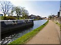

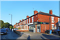
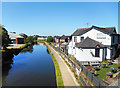
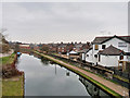
50 photos from this area
Area Information
Key information about the M33 2AW including its size, population, and administrative classification.
- Area Type
- Postcode
- Area Size
- 5469 m²
- Population
- 2158
- Population Density
- 4868 people/km²
House Prices in M33 2AW
11
Properties
£599,375
Average Sold Price
£392,500
Lowest Price
£930,000
Highest Price
Showing 11 properties
| Address | Type | Beds | Baths | Last Sale Price | Last Sale Date | |
|---|---|---|---|---|---|---|
| 21 Broad Road, Sale, M33 2AW | Semi-detached | 5 | 2 | £930,000 | Jun 2025 | |
| 15 Broad Road, Sale, M33 2AW | house | - | - | £600,000 | Mar 2021 | |
| 19 Broad Road, Sale, M33 2AW | house | - | - | £630,500 | Mar 2021 | |
| 31 Broad Road, Sale, M33 2AW | house | - | - | £640,000 | Sep 2020 | |
| 27 Broad Road, Sale, M33 2AW | house | - | - | £392,500 | Nov 2016 | |
| 23 Broad Road, Sale, M33 2AW | house | - | - | £612,000 | Jan 2016 | |
| 33 Broad Road, Sale, M33 2AW | Semi-detached | 5 | - | £550,000 | Jun 2015 | |
| 35 Broad Road, Sale, M33 2AW | Semi-detached | - | - | £440,000 | May 2005 | |
| 25 Broad Road, Sale, M33 2AW | house | - | - | - | - | |
| 17 Broad Road, Sale, M33 2AW | Terraced | - | - | - | - |
Page 1 of 2
Energy Efficiency in M33 2AW
Amenities
Schools
| Rank | School | Type | Entry gender | Ages |
|---|
Explore more schools in this area
Go to Schools tabDemographics
Household Size
One person
most common
Accommodation Type
Flats
most common
Tenure
64
majority
Ethnic Group
White
most common
Religion
N/A
most common
Household Composition
N/A
most common
Age
47
median
Adults (30-64 years)
most common
Household Deprivation
N/A
with no deprivation
NS-SEC
54
in Lower managerial occupations
Explore more demographic insights in this area
Go to Demographics tabPlanning
Planning Constraints
- Flood RiskPremium
- Ramsar Wetland SitesPremium
- Area of Outstanding Natural BeautyPremium
- Protected Nature ReservePremium
- Protected WoodlandPremium