Area Overview for M32 9HP
Photos of M32 9HP
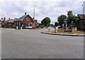
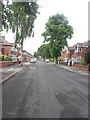
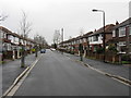
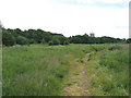
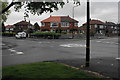
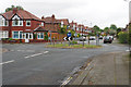
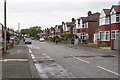
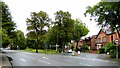

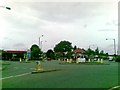
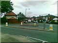

35 photos from this area
Area Information
Key information about the M32 9HP including its size, population, and administrative classification.
- Area Type
- Postcode
- Area Size
- 1.0 hectares
- Population
- 1606
- Population Density
- 6507 people/km²
House Prices in M32 9HP
21
Properties
£189,438
Average Sold Price
£49,500
Lowest Price
£322,500
Highest Price
Showing 21 properties
| Address | Type | Beds | Baths | Last Sale Price | Last Sale Date | |
|---|---|---|---|---|---|---|
| 57 Arlington Road, Stretford, M32 9HP | house | - | - | £312,000 | Dec 2023 | |
| 38 Arlington Road, Stretford, M32 9HP | Semi-detached | 3 | 1 | £322,500 | Feb 2023 | |
| 59 Arlington Road, Stretford, M32 9HP | Semi-detached | 3 | 1 | £316,500 | Feb 2021 | |
| 30 Arlington Road, Stretford, M32 9HP | Semi-detached | 3 | - | £300,000 | Feb 2021 | |
| 32 Arlington Road, Stretford, M32 9HP | Semi-detached | 4 | 2 | £303,000 | Oct 2018 | |
| 36 Arlington Road, Stretford, M32 9HP | house | - | - | £215,000 | Oct 2015 | |
| 46 Arlington Road, Stretford, M32 9HP | Detached | 3 | - | £239,000 | Apr 2014 | |
| 61 Arlington Road, Stretford, M32 9HP | house | - | - | £194,000 | Oct 2013 | |
| 67 Arlington Road, Stretford, M32 9HP | Semi-detached | 3 | 1 | £160,000 | May 2013 | |
| 65 Arlington Road, Stretford, M32 9HP | house | 3 | - | £163,000 | Sep 2012 |
Page 1 of 3
Energy Efficiency in M32 9HP
Amenities
Schools
| Rank | School | Type | Entry gender | Ages |
|---|
Explore more schools in this area
Go to Schools tabDemographics
Household Size
Family (3-5 people)
most common
Accommodation Type
Houses
most common
Tenure
89
majority
Ethnic Group
White
most common
Religion
N/A
most common
Household Composition
N/A
most common
Age
47
median
Adults (30-64 years)
most common
Household Deprivation
N/A
with no deprivation
NS-SEC
38
in Lower managerial occupations
Explore more demographic insights in this area
Go to Demographics tabPlanning
Planning Constraints
- Flood RiskPremium
- Ramsar Wetland SitesPremium
- Area of Outstanding Natural BeautyPremium
- Protected Nature ReservePremium
- Protected WoodlandPremium