Area Overview for M32 9BS
Photos of M32 9BS
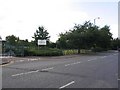
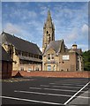
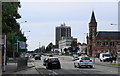
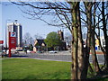
98 photos from this area
Area Information
Key information about the M32 9BS including its size, population, and administrative classification.
- Area Type
- Postcode
- Area Size
- 7209 m²
- Population
- 1802
- Population Density
- 2663 people/km²
House Prices in M32 9BS
25
Properties
£153,524
Average Sold Price
£33,000
Lowest Price
£295,000
Highest Price
Showing 25 properties
| Address | Type | Beds | Baths | Last Sale Price | Last Sale Date | |
|---|---|---|---|---|---|---|
| 31 Ryecroft Road, Stretford, M32 9BS | house | - | - | £295,000 | Nov 2018 | |
| 9 Ryecroft Road, Stretford, M32 9BS | house | - | - | £248,000 | Sep 2016 | |
| 21 Ryecroft Road, Stretford, M32 9BS | house | 4 | - | £235,000 | Mar 2016 | |
| 45 Ryecroft Road, Stretford, M32 9BS | Semi-detached | - | - | £199,000 | Nov 2008 | |
| 1 Ryecroft Road, Stretford, M32 9BS | Terraced | 3 | - | £162,500 | Sep 2008 | |
| 3 Ryecroft Road, Stretford, M32 9BS | Terraced | - | - | £163,000 | Jul 2008 | |
| 5 Ryecroft Road, Stretford, M32 9BS | Semi-detached | - | - | £152,000 | Aug 2004 | |
| 47 Ryecroft Road, Stretford, M32 9BS | Semi-detached | - | - | £124,000 | Jan 2004 | |
| 37 Ryecroft Road, Stretford, M32 9BS | Terraced | - | - | £129,950 | Jul 2003 | |
| 11 Ryecroft Road, Stretford, M32 9BS | Terraced | - | - | £53,836 | May 1998 |
Page 1 of 3
Energy Efficiency in M32 9BS
Amenities
Schools
| Rank | School | Type | Entry gender | Ages |
|---|
Explore more schools in this area
Go to Schools tabDemographics
Household Size
One person
most common
Accommodation Type
Houses
most common
Tenure
50
majority
Ethnic Group
White
most common
Religion
N/A
most common
Household Composition
N/A
most common
Age
47
median
Adults (30-64 years)
most common
Household Deprivation
N/A
with no deprivation
NS-SEC
34
in Lower managerial occupations
Explore more demographic insights in this area
Go to Demographics tabPlanning
Planning Constraints
- Flood RiskPremium
- Ramsar Wetland SitesPremium
- Area of Outstanding Natural BeautyPremium
- Protected Nature ReservePremium
- Protected WoodlandPremium