Area Overview for M32 8RA
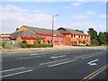
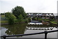
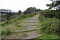
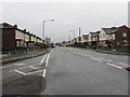
Photos of M32 8RA


Area Information
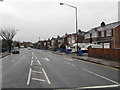
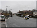
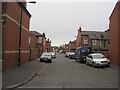
Living in M32 8RA means being part of a tightly knit residential cluster in England, where 1,701 people reside across 6.2 hectares. The area’s compact size fosters a sense of community, with a population density of 572 people per square kilometre. Daily life here is shaped by its proximity to transport hubs and local amenities. The area is predominantly home to adults aged 30–64, many of whom own their properties. With 79% of homes occupied by owners, the neighbourhood leans towards stability, though its small footprint means limited expansion. Residents benefit from nearby rail and metro stations, including Trafford Park and Manchester United FC stations, which connect to major urban centres. The area’s digital connectivity is robust, with a broadband score of 100, ensuring seamless internet access for both work and leisure. However, the absence of natural constraints like AONB or protected woodlands means the landscape is unremarkable, prioritising practicality over scenic appeal. For those seeking a quiet, functional base with easy access to city amenities, M32 8RA offers a straightforward, no-frills living experience.
- Area Type
- Postcode
- Area Size
- 6.2 hectares
- Population
- 1701
- Population Density
- 572 people/km²
The property market in M32 8RA is characterised by high home ownership, with 79% of properties occupied by owners. This suggests a stable, long-term demographic rather than a transient rental market. The accommodation type is predominantly houses, which is unusual for smaller postcode areas but indicates a focus on family-sized homes. Given the area’s compact size and limited expansion, the housing stock is likely to be mature, with few new developments. For buyers, this means a limited inventory of properties, potentially driving competition among existing residents. The absence of flats or apartments suggests that the market caters to those seeking single-family homes rather than urban living. However, the small area’s proximity to transport links like Trafford Park and Manchester United FC stations may offset its lack of scale, offering residents access to broader urban opportunities. Buyers should consider the area’s fixed size when assessing long-term value, as growth is unlikely.
House Prices in M32 8RA
No properties found in this postcode.
Energy Efficiency in M32 8RA
Life in M32 8RA is shaped by its proximity to retail and transport hubs. Within practical reach are shops like Co-op Barton and Asda Sevenways, offering everyday essentials. The area’s rail stations, including Trafford Park and Manchester United FC, provide easy access to leisure and employment in Manchester. Metro stations at Village, Parkway, and Stretford further enhance connectivity, while the nearby City Airport Manchester caters to travel needs. For residents, the combination of retail options and transport links means daily errands and commuting are efficient. The presence of multiple stations also allows for flexible travel, whether heading to city centres or suburban areas. While the area itself is small, its integration with larger networks ensures residents can access a broader range of activities. The lack of dedicated parks or leisure facilities within the postcode suggests that recreation is primarily sourced elsewhere, but the transport links mitigate this limitation. Overall, M32 8RA offers a lifestyle focused on practicality and accessibility.
Amenities
Schools
| Rank | School | Type | Entry gender | Ages |
|---|
Explore more schools in this area
Go to Schools tabDemographics
The community in M32 8RA is defined by its age profile and home ownership rates. With a median age of 47, the area is heavily populated by adults aged 30–64, suggesting a mature, established demographic. Home ownership is high, at 79%, indicating a preference for long-term residency over rental properties. The accommodation type is predominantly houses, which aligns with the area’s residential character. The predominant ethnic group is White, reflecting a homogenous population. While no specific data on deprivation is provided, the high home ownership and stable age range suggest a relatively secure economic environment. However, the absence of detailed diversity metrics means the community’s cultural composition remains unexplored. The age group’s focus on middle-aged adults implies a balance between family life and retirement, with fewer young families or students present. This profile shapes a community that prioritises stability and familiarity over rapid change.
Household Size
Accommodation Type
Tenure
Ethnic Group
Religion
Household Composition
Age
Household Deprivation
NS-SEC
Explore more demographic insights in this area
Go to Demographics tabPlanning
Planning Constraints
- Flood RiskPremium
- Ramsar Wetland SitesPremium
- Area of Outstanding Natural BeautyPremium
- Protected Nature ReservePremium
- Protected WoodlandPremium