Area Overview for M32 8HZ
Photos of M32 8HZ


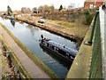
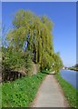
98 photos from this area
Area Information
Key information about the M32 8HZ including its size, population, and administrative classification.
- Area Type
- Postcode
- Area Size
- 1.5 hectares
- Population
- Not available
- Population Density
- Not available
House Prices in M32 8HZ
30
Properties
£125,431
Average Sold Price
£36,500
Lowest Price
£330,000
Highest Price
Showing 30 properties
| Address | Type | Beds | Baths | Last Sale Price | Last Sale Date | |
|---|---|---|---|---|---|---|
| 22 Larch Avenue, Stretford, M32 8HZ | Flat | 2 | 1 | £165,000 | Mar 2025 | |
| 23 Larch Avenue, Stretford, M32 8HZ | Flat | - | - | £155,000 | Oct 2024 | |
| 32 Larch Avenue, Stretford, M32 8HZ | Flat | - | - | £137,500 | Jan 2022 | |
| 8 Larch Avenue, Stretford, M32 8HZ | house | - | - | £330,000 | Dec 2020 | |
| 13 Larch Avenue, Stretford, M32 8HZ | Flat | - | - | £135,000 | Feb 2019 | |
| 5 Larch Avenue, Stretford, M32 8HZ | house | 3 | - | £124,700 | Sep 2014 | |
| 3 Larch Avenue, Stretford, M32 8HZ | house | 3 | - | £175,000 | Apr 2014 | |
| 25 Larch Avenue, Stretford, M32 8HZ | Flat | 2 | 1 | £76,000 | Jul 2010 | |
| 1 Larch Avenue, Stretford, M32 8HZ | house | - | - | £172,000 | Jul 2010 | |
| 11 Larch Avenue, Stretford, M32 8HZ | house | - | - | £177,000 | Jun 2007 |
Page 1 of 3
Energy Efficiency in M32 8HZ
Amenities
Schools
| Rank | School | Type | Entry gender | Ages |
|---|
Explore more schools in this area
Go to Schools tabDemographics
Household Size
One person
most common
Accommodation Type
Houses
most common
Tenure
36
majority
Ethnic Group
White
most common
Religion
N/A
most common
Household Composition
N/A
most common
Age
47
median
Adults (30-64 years)
most common
Household Deprivation
N/A
with no deprivation
NS-SEC
30
in Lower managerial occupations
Explore more demographic insights in this area
Go to Demographics tabPlanning
Planning Constraints
- Flood RiskPremium
- Ramsar Wetland SitesPremium
- Area of Outstanding Natural BeautyPremium
- Protected Nature ReservePremium
- Protected WoodlandPremium