Area Overview for M32 8EB
Photos of M32 8EB

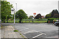
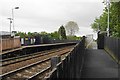
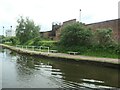
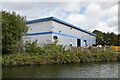
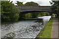
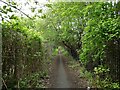
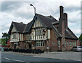
45 photos from this area
Area Information
Key information about the M32 8EB including its size, population, and administrative classification.
- Area Type
- Postcode
- Area Size
- 1.8 hectares
- Population
- 1701
- Population Density
- 572 people/km²
House Prices in M32 8EB
32
Properties
£144,380
Average Sold Price
£13,560
Lowest Price
£310,000
Highest Price
Showing 32 properties
| Address | Type | Beds | Baths | Last Sale Price | Last Sale Date | |
|---|---|---|---|---|---|---|
| 14 Raglan Road, Stretford, M32 8EB | house | 3 | - | £127,540 | Feb 2022 | |
| 22 Raglan Road, Stretford, M32 8EB | house | - | - | £273,000 | Feb 2022 | |
| 48 Raglan Road, Stretford, M32 8EB | Semi-detached | 3 | 1 | £310,000 | Apr 2021 | |
| 4 Raglan Road, Stretford, M32 8EB | Semi-detached | 3 | 1 | £234,000 | Oct 2019 | |
| 20 Raglan Road, Stretford, M32 8EB | Semi-detached | 3 | 1 | £235,000 | May 2019 | |
| 18 Raglan Road, Stretford, M32 8EB | Semi-detached | 3 | 1 | £230,000 | Dec 2017 | |
| 8 Raglan Road, Stretford, M32 8EB | Semi-detached | 3 | 1 | £210,000 | Nov 2017 | |
| 36 Raglan Road, Stretford, M32 8EB | house | - | - | £220,000 | Jul 2017 | |
| 62 Raglan Road, Stretford, M32 8EB | house | - | - | £165,000 | Oct 2009 | |
| 56 Raglan Road, Stretford, M32 8EB | Semi-detached | - | - | £140,000 | Aug 2009 |
Page 1 of 4
Energy Efficiency in M32 8EB
Amenities
Schools
| Rank | School | Type | Entry gender | Ages |
|---|
Explore more schools in this area
Go to Schools tabDemographics
Household Size
Family (3-5 people)
most common
Accommodation Type
Houses
most common
Tenure
79
majority
Ethnic Group
White
most common
Religion
N/A
most common
Household Composition
N/A
most common
Age
47
median
Adults (30-64 years)
most common
Household Deprivation
N/A
with no deprivation
NS-SEC
33
in Lower managerial occupations
Explore more demographic insights in this area
Go to Demographics tabPlanning
Planning Constraints
- Flood RiskPremium
- Ramsar Wetland SitesPremium
- Area of Outstanding Natural BeautyPremium
- Protected Nature ReservePremium
- Protected WoodlandPremium