Area Overview for M32 0XU
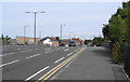
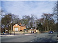
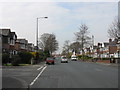
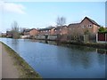
Photos of M32 0XU


Area Information
M32 0XU is a small residential postcode area in England, home to 1716 residents. Its compact size means it is a tightly knit community, likely centred around local amenities and transport links. The area’s proximity to Stretford, Old Trafford, and nearby railway stations suggests it is well integrated with surrounding towns and cities. Daily life here is shaped by its accessibility to major transport hubs, including Trafford Park Railway Station and Manchester United FC Railway Station, which connect residents to broader networks. The presence of multiple retail outlets like Lidl Stretford and Co-op Taylors indicates a practical approach to shopping, while the area’s digital connectivity scores—93 for broadband and 85 for mobile—support modern lifestyles. Though small, M32 0XU offers a balance of convenience and connectivity, with nearby airports and rail services enhancing its appeal for commuters. The area’s character is defined by its mix of residential clusters and practical infrastructure, making it suitable for those prioritising accessibility over sprawling suburban environments.
- Area Type
- Postcode
- Area Size
- Not available
- Population
- 1716
- Population Density
- 2657 people/km²
House Prices in M32 0XU
No properties found in this postcode.
Energy Efficiency in M32 0XU
Residents of M32 0XU enjoy a range of amenities within practical reach, enhancing daily life. Retail options include Lidl Stretford, Heron Stretford, and Co-op Taylors, providing essential shopping and grocery needs. The area’s proximity to rail and metro stations connects residents to leisure opportunities in nearby towns, such as Old Trafford’s sporting venues or Trafford Park’s business district. While parks and green spaces are not explicitly listed, the absence of protected nature reserves or AONB coverage suggests the area is more urban in character. The presence of multiple airports nearby may offer convenience for travel, though local leisure options appear focused on retail and transport hubs. The mix of amenities reflects a practical, commuter-friendly lifestyle, prioritising accessibility over expansive recreational spaces.
Amenities
Schools
Residents of M32 0XU have access to two notable schools within practical reach: Longford Park School, a special school, and Primary Behaviour Support, which falls under the 'other' category. These institutions cater to specific educational needs, with Longford Park School likely providing tailored support for students with additional requirements. The mix of school types suggests the area serves families with diverse educational priorities, though the absence of mainstream primary or secondary schools may require parents to look further afield for broader academic options. The proximity of these schools to residential areas indicates a focus on accessibility for families, though the lack of detailed Ofsted ratings means their performance remains unquantified. For parents seeking specialised education, M32 0XU offers direct access, but those prioritising traditional schooling may need to consider nearby districts.
| Rank | School | Type | Entry gender | Ages |
|---|
Explore more schools in this area
Go to Schools tabDemographics
Household Size
Accommodation Type
Tenure
Ethnic Group
Religion
Household Composition
Age
Household Deprivation
NS-SEC
Explore more demographic insights in this area
Go to Demographics tabPlanning
Planning Constraints
- Flood RiskPremium
- Ramsar Wetland SitesPremium
- Area of Outstanding Natural BeautyPremium
- Protected Nature ReservePremium
- Protected WoodlandPremium