Area Overview for M32 0RB
Photos of M32 0RB
Area Information
Living in M32 0RB means inhabiting a compact, densely populated residential cluster in England. The area covers 7,966 square metres and is home to 2,599 people, resulting in a population density of 326,261 people per square kilometre. This high density suggests a tightly knit community, though the area’s small size means it is not sprawling. The median age of 47 indicates a mature demographic, with adults aged 30–64 forming the largest age group. Daily life here is likely shaped by proximity to amenities, with retail, transport, and cultural sites within practical reach. The area’s proximity to Manchester United FC Railway Station and City Airport Manchester underscores its connectivity to both urban hubs and regional travel. While the housing stock is predominantly houses, the high population density implies a mix of household types. For those seeking a compact, accessible location with established infrastructure, M32 0RB offers a blend of residential comfort and urban convenience.
- Area Type
- Postcode
- Area Size
- 7966 m²
- Population
- 2599
- Population Density
- 3214 people/km²
The property market in M32 0RB is defined by a 55% home ownership rate, with houses forming the primary accommodation type. This suggests a community where many residents own their homes, though the area’s small size means the housing stock is limited. The predominance of houses over flats or apartments may appeal to buyers seeking traditional family homes. However, the high population density—326,261 people per square kilometre—implies that properties are closely packed, potentially leading to competition for available homes. Given the area’s compact nature, buyers should consider the immediate surroundings for additional options. The mix of owner-occupied and rental properties could indicate a stable market, though the lack of specific data on property prices or trends means further research is necessary for a full picture. For those prioritising proximity to amenities and transport, M32 0RB’s housing offers a balance of residential comfort and urban accessibility.
House Prices in M32 0RB
No properties found in this postcode.
Energy Efficiency in M32 0RB
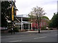
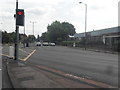
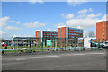
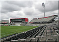
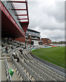
Residents of M32 0RB enjoy a range of amenities within practical reach, enhancing daily life. Retail options include Tesco Stretford, Co-op Taylors, and Aldi White City Retail Park, offering convenience for grocery shopping and daily errands. The area’s transport links connect to cultural and leisure sites such as Old Trafford, the Imperial War Museum, and the Wharfside metro stop, which may provide access to entertainment and historical attractions. The proximity to Manchester United FC Railway Station and City Airport Manchester also facilitates travel to events or business trips. While the data does not specify parks or green spaces, the absence of protected nature reserves or AONB coverage suggests that natural areas may be limited. Nonetheless, the density of shops, transport, and cultural venues indicates a lifestyle focused on accessibility and urban connectivity, ideal for those prioritising convenience over expansive outdoor spaces.
Amenities
Schools
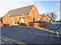
Residents of M32 0RB have access to two primary schools: Gorse Hill Primary School and Stretford High School, both of which hold a ‘good’ Ofsted rating. The presence of two primary schools within the area suggests a focus on early education, though no secondary schools are listed in the data. For families with young children, this proximity to primary education is a key advantage, reducing the need for long commutes. The ‘good’ Ofsted ratings indicate that both schools meet acceptable standards of teaching and pupil outcomes. However, parents seeking secondary education may need to look beyond the immediate area. The absence of secondary schools in the data highlights a potential gap for older children, though the availability of nearby transport links—such as Manchester United FC Railway Station—could mitigate this by enabling access to schools in larger towns or cities.
| Rank | School | Type | Entry gender | Ages |
|---|
Explore more schools in this area
Go to Schools tabDemographics
The community in M32 0RB is predominantly composed of adults aged 30–64, with a median age of 47. This suggests a population skewed towards middle-aged individuals, likely including families and professionals. Home ownership stands at 55%, indicating a mix of owner-occupied properties and rental units. The accommodation type is primarily houses, which may reflect a preference for single-family homes over flats or apartments. The predominant ethnic group is White, though the data does not specify further diversity metrics. The high population density of 326,261 people per square kilometre, despite the area’s small size, implies a tightly packed residential environment. This density could influence the character of the neighbourhood, fostering a close-knit community but potentially limiting space for expansion. The absence of specific deprivation data means quality of life is inferred from the availability of amenities and services, which appear to be reasonably well provisioned.
Household Size
Accommodation Type
Tenure
Ethnic Group
Religion
Household Composition
Age
Household Deprivation
NS-SEC
Explore more demographic insights in this area
Go to Demographics tabPlanning
Planning Constraints
- Flood RiskPremium
- Ramsar Wetland SitesPremium
- Area of Outstanding Natural BeautyPremium
- Protected Nature ReservePremium
- Protected WoodlandPremium