Area Overview for M32 0PY
Photos of M32 0PY

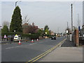
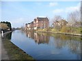
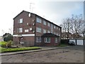

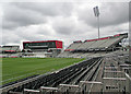
72 photos from this area
Area Information
Key information about the M32 0PY including its size, population, and administrative classification.
- Area Type
- Postcode
- Area Size
- 1.6 hectares
- Population
- 2160
- Population Density
- 2946 people/km²
House Prices in M32 0PY
23
Properties
£136,453
Average Sold Price
£35,300
Lowest Price
£295,000
Highest Price
Showing 23 properties
| Address | Type | Beds | Baths | Last Sale Price | Last Sale Date | |
|---|---|---|---|---|---|---|
| 8 Beresford Road, Stretford, M32 0PY | Semi-detached | 3 | 1 | £257,500 | Apr 2023 | |
| 12 Beresford Road, Stretford, M32 0PY | Semi-detached | 3 | 1 | £295,000 | Oct 2022 | |
| 36 Beresford Road, Stretford, M32 0PY | Semi-detached | 3 | - | £115,000 | Jul 2013 | |
| 14 Beresford Road, Stretford, M32 0PY | Semi-detached | 3 | - | £98,000 | Nov 2012 | |
| 40 Beresford Road, Stretford, M32 0PY | Detached | 3 | - | £185,000 | Oct 2012 | |
| 42 Beresford Road, Stretford, M32 0PY | Detached | - | - | £177,500 | Nov 2004 | |
| 6 Beresford Road, Stretford, M32 0PY | house | - | - | £121,277 | Jun 2004 | |
| 18 Beresford Road, Stretford, M32 0PY | house | 3 | - | £39,950 | Mar 1998 | |
| 38 Beresford Road, Stretford, M32 0PY | Semi-detached | - | - | £35,300 | Jul 1996 | |
| 3, Beresford Court, 26 Beresford Road, Stretford, M32 0PY | Flat | - | - | £40,000 | Jul 1996 |
Page 1 of 3
Energy Efficiency in M32 0PY
Amenities
Schools
| Rank | School | Type | Entry gender | Ages |
|---|
Explore more schools in this area
Go to Schools tabDemographics
Household Size
One person
most common
Accommodation Type
Houses
most common
Tenure
46
majority
Ethnic Group
White
most common
Religion
N/A
most common
Household Composition
N/A
most common
Age
47
median
Adults (30-64 years)
most common
Household Deprivation
N/A
with no deprivation
NS-SEC
31
in Lower managerial occupations
Explore more demographic insights in this area
Go to Demographics tabPlanning
Planning Constraints
- Flood RiskPremium
- Ramsar Wetland SitesPremium
- Area of Outstanding Natural BeautyPremium
- Protected Nature ReservePremium
- Protected WoodlandPremium