Area Overview for M32 0HH
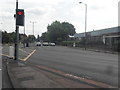
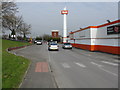
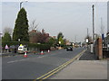
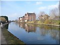
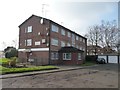
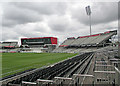
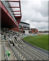
Photos of M32 0HH


Area Information
Living in M32 0HH means being part of a small, tightly knit residential cluster in England with a population of 2,160. This area is defined by its compact size and proximity to key services, making it a practical choice for those seeking a balance between suburban comfort and urban accessibility. The community here is predominantly composed of adults aged 30–64, reflecting a mature demographic profile. Daily life is shaped by the availability of local amenities, including retail hubs, transport links, and educational institutions. While the area lacks large-scale infrastructure, its proximity to Manchester United FC Railway Station and Trafford Park Railway Station ensures easy access to broader networks. The presence of both primary and sixth-form education options supports families, while the high broadband score of 95 ensures reliable digital connectivity. However, the area’s small size means it is not suited to those seeking expansive green spaces or sprawling housing developments. For buyers prioritising convenience and practicality, M32 0HH offers a focused, functional living environment.
- Area Type
- Postcode
- Area Size
- Not available
- Population
- 2160
- Population Density
- 2946 people/km²
The property market in M32 0HH is characterised by a 46% home ownership rate, indicating that less than half of properties are owner-occupied. The predominant accommodation type is houses, which suggests a focus on single-family homes rather than apartments or terraced housing. This aligns with the area’s small, residential cluster identity, where larger properties may be more common. For buyers, this means the market is not dominated by high-density developments or rental blocks, but rather a mix of private homes and possibly some rental stock. The limited size of the area means property choices are constrained, and buyers should consider proximity to nearby towns for more extensive options. The house-centric nature of the market may appeal to those seeking traditional family homes, though the low home ownership rate could signal a higher proportion of tenants.
House Prices in M32 0HH
No properties found in this postcode.
Energy Efficiency in M32 0HH
Residents of M32 0HH benefit from a range of nearby amenities, including five retail outlets such as Tesco Stretford, Aldi White City Retail Park, and M&S Stretford. These shops provide everyday convenience, from groceries to clothing. The area’s transport links also grant access to leisure and cultural hubs, with the Old Trafford metro stop offering proximity to the iconic football stadium. While there are no named parks or recreational spaces listed in the data, the presence of multiple railway stations and the nearby Trafford Park suggest opportunities for outdoor activities in surrounding areas. The single airport nearby adds to the area’s accessibility. The mix of retail, transport, and leisure options creates a functional lifestyle, though the absence of detailed green space information means the quality of outdoor amenities remains unquantified.
Amenities
Schools
Residents of M32 0HH have access to Great Stone Boys’ School, a primary institution, and North Trafford College of Further Education, a sixth-form college. These two schools cater to different educational stages, offering a practical range of options for families. The absence of secondary schools in the immediate vicinity means students may need to travel to nearby areas for comprehensive secondary education. However, the presence of both primary and post-16 education options suggests the area is well-served for younger children and those pursuing further education. The lack of detailed Ofsted ratings for these schools means their academic performance remains unquantified, though their types indicate a focus on foundational and vocational learning. For families prioritising proximity to schools, the mix of primary and sixth-form colleges provides a starting point, though additional research into local secondary education may be necessary.
| Rank | School | Type | Entry gender | Ages |
|---|
Explore more schools in this area
Go to Schools tabDemographics
The community in M32 0HH is largely composed of adults aged 30–64, with a median age of 47. This suggests a population skewed towards middle-aged individuals, many of whom may be in their prime working years or nearing retirement. Home ownership stands at 46%, indicating a mixed market where rental properties also play a role. The predominant accommodation type is houses, which aligns with the area’s small, residential character. The majority of residents identify as White, though no specific data on other ethnic groups is provided. The absence of detailed diversity statistics means the full range of cultural influences in the area remains unclear. The relatively low home ownership rate may reflect a reliance on rental housing, which could impact long-term stability for some residents. This demographic profile suggests a community focused on established living rather than rapid growth or generational change.
Household Size
Accommodation Type
Tenure
Ethnic Group
Religion
Household Composition
Age
Household Deprivation
NS-SEC
Explore more demographic insights in this area
Go to Demographics tabPlanning
Planning Constraints
- Flood RiskPremium
- Ramsar Wetland SitesPremium
- Area of Outstanding Natural BeautyPremium
- Protected Nature ReservePremium
- Protected WoodlandPremium