Area Overview for M32 0FR
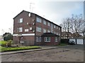
Photos of M32 0FR


Area Information
M32 0FR is a small, tightly knit residential cluster in England, home to 2,599 residents. This area is characterised by its compact size and proximity to key urban hubs, offering a balance between suburban tranquillity and access to larger city amenities. The community is predominantly composed of adults aged 30–64, reflecting a mature demographic profile. Living here means navigating a landscape where houses outnumber flats, with 55% of properties owner-occupied. The area’s charm lies in its practicality: broadband speeds are near flawless, with a score of 99, and mobile coverage is strong enough for most needs. Nearby, retail options like Co-op Taylors and Tesco Stretford provide daily conveniences, while rail links such as Trafford Park Railway Station offer swift access to Manchester’s transport network. For those seeking a quieter life, the absence of protected natural sites or flood risks adds to the area’s appeal, though crime rates are notably higher than average. M32 0FR is ideal for those prioritising connectivity and proximity to services, though potential buyers should weigh local safety considerations against the benefits of a well-served, compact community.
- Area Type
- Postcode
- Area Size
- Not available
- Population
- 2599
- Population Density
- 3214 people/km²
The property market in M32 0FR is defined by a 55% home ownership rate, with houses making up the majority of the housing stock. This suggests a community where long-term residency is common, though the area is not dominated by rental properties. The prevalence of houses over flats indicates a focus on family-friendly or more spacious living arrangements, which may appeal to buyers seeking stability or space. However, the small size of the area means the housing stock is limited, and opportunities for new builds or conversions are likely constrained. For buyers, this translates to a market where existing properties are in demand, but competition may be fierce due to the area’s compact nature. The owner-occupied majority implies a relatively stable market, but with limited scope for expansion. Those considering purchase should note that while the area is well-served by transport and amenities, the small size and focus on single-family homes may limit options for those seeking alternative property types.
House Prices in M32 0FR
No properties found in this postcode.
Energy Efficiency in M32 0FR
Life in M32 0FR is shaped by its proximity to a range of amenities. Retail options include Co-op Taylors, Tesco Stretford, and Lidl Stretford, providing everyday shopping needs within walking distance. Rail and metro stations like Trafford Park and Old Trafford ensure easy access to Manchester’s cultural and commercial centres, while the Chorlton Street Coach Station offers additional transport links. Nearby, the area’s connection to Manchester United FC Railway Station highlights its appeal to sports enthusiasts. For leisure, the presence of multiple rail stations and proximity to airports cater to both local and international travel. The area’s compact size means amenities are concentrated, reducing the need for long commutes. However, the absence of detailed information on parks or recreational spaces leaves gaps in understanding the full extent of leisure opportunities. Despite this, the combination of retail, transport, and connectivity creates a functional, if modest, lifestyle foundation.
Amenities
Schools
Residents of M32 0FR have access to two primary schools: Gorse Hill Primary School and Stretford High School, both of which hold an Ofsted rating of ‘good’. These institutions cater to younger children, providing a foundation for early education within the area. The presence of two primary schools suggests a focus on local schooling, reducing the need for long commutes to secondary education. However, no secondary schools are listed in the data, meaning families may need to look beyond M32 0FR for high school options. The ‘good’ Ofsted ratings indicate that both schools meet acceptable standards, though further details on curriculum, facilities, or performance metrics are not provided. For parents prioritising primary education, the availability of two locally rated schools offers a practical advantage, though the absence of secondary options may influence broader educational planning.
| Rank | School | Type | Entry gender | Ages |
|---|
Explore more schools in this area
Go to Schools tabDemographics
The population of M32 0FR is 2,599, with a median age of 47, indicating a mature, stable community. The majority of residents fall within the 30–64 age range, suggesting a demographic skewed towards middle-aged adults. Home ownership is at 55%, with houses being the predominant type of accommodation. This reflects a residential area where long-term occupancy is common, though rental properties are less prevalent. The predominant ethnic group is White, with no specific data provided on other demographics. The age profile implies a community with established careers and families, though the absence of data on younger or older age groups limits insight into generational diversity. The home ownership rate suggests a degree of economic stability, but with only 55% of properties owned by residents, a significant portion of the housing stock may be rented out, potentially influencing local dynamics. The lack of detailed diversity metrics means the area’s cultural composition remains underexplored in this context.
Household Size
Accommodation Type
Tenure
Ethnic Group
Religion
Household Composition
Age
Household Deprivation
NS-SEC
Explore more demographic insights in this area
Go to Demographics tabPlanning
Planning Constraints
- Flood RiskPremium
- Ramsar Wetland SitesPremium
- Area of Outstanding Natural BeautyPremium
- Protected Nature ReservePremium
- Protected WoodlandPremium