Area Overview for M32 0BZ
Photos of M32 0BZ


Area Information
Living in M32 0BZ means being part of a small, tightly knit residential cluster in England. With a population of 1,746, this area offers a quiet, community-focused environment. The postcode is characterised by a predominance of houses, reflecting a stable, long-term residential profile. Daily life here is shaped by proximity to local amenities, including retail outlets like Aldi and Lidl in Stretford, and transport links such as Trafford Park Railway Station. The area’s compact size means residents can access nearby towns like Stretford and Old Trafford with ease, while the surrounding infrastructure supports both practical needs and leisure activities. The median age of 47 suggests a mature demographic, with a strong presence of adults aged 30–64. This makes M32 0BZ a place where families and established professionals coexist, balancing routine with the convenience of nearby services. The area’s lack of significant environmental constraints, such as protected woodlands or AONB designations, ensures development remains straightforward, though buyers should note the high crime risk. For those seeking a manageable, well-connected residential spot with a focus on practicality, M32 0BZ provides a distinct blend of stability and accessibility.
- Area Type
- Postcode
- Area Size
- Not available
- Population
- 1746
- Population Density
- 7009 people/km²
The property market in M32 0BZ is dominated by owner-occupied homes, with 71% of properties in private hands. This high rate of home ownership suggests a stable market where long-term residency is common, reducing the frequency of property turnover. The predominance of houses over flats or apartments indicates a focus on family-friendly, standalone living, which may appeal to buyers seeking space and privacy. Given the area’s small size, the housing stock is likely limited to a few key developments, meaning buyers should consider the broader surrounding areas for more options. The absence of rental data means it is unclear whether the market is primarily driven by owner-occupiers or investors. However, the high home ownership rate implies that properties here are more likely to be family homes rather than speculative purchases. For those considering M32 0BZ, the focus on houses and the mature demographic suggest a market where properties are held for the long term, offering potential for stability but requiring careful evaluation of local supply.
House Prices in M32 0BZ
No properties found in this postcode.
Energy Efficiency in M32 0BZ
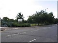
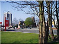
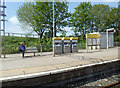
Residents of M32 0BZ have access to a range of amenities within practical reach. Local retail options include Aldi and Lidl in Stretford, providing everyday shopping convenience. The area’s proximity to Stretford and Old Trafford ensures access to larger retail centres, dining venues, and leisure facilities. Transport links such as Trafford Park Railway Station and Manchester United FC Railway Station connect residents to major hubs, while nearby airports like Manchester City Airport offer travel flexibility. Parks and green spaces are not explicitly detailed in the data, but the absence of protected natural areas suggests open spaces may be limited. The area’s compact size means most amenities are within walking or short driving distance, supporting a lifestyle that balances convenience with accessibility. For those prioritising practicality, the mix of retail, transport, and regional connectivity makes M32 0BZ a functional base for daily life, though buyers should consider the need for nearby recreational options.
Amenities
Schools
The nearest school to M32 0BZ is St Ann’s RC Junior School, a primary institution serving the area. While no Ofsted rating is provided, the presence of a single primary school suggests that families with young children may need to look beyond the immediate postcode for secondary education options. The lack of secondary schools within M32 0BZ itself means that parents should consider the proximity of larger towns like Stretford or Old Trafford for comprehensive schooling. The school’s religious affiliation as a Roman Catholic institution may be a factor for families prioritising faith-based education. However, the absence of additional schools or data on their performance means buyers should conduct further research into local education provision. For those valuing school quality, the area’s limited school options could be a consideration, though the existing primary school provides a foundation for early years education.
| Rank | School | Type | Entry gender | Ages |
|---|
Explore more schools in this area
Go to Schools tabDemographics
The community in M32 0BZ is predominantly composed of adults aged 30–64, with a median age of 47. This suggests a mature, established population, likely with long-term ties to the area. Home ownership is high at 71%, indicating a strong preference for property investment over rental living. The accommodation type is largely houses, reflecting a residential profile that prioritises private, standalone dwellings. The predominant ethnic group is White, which aligns with broader demographic trends in the region. While specific data on deprivation or diversity is not provided, the high home ownership rate and stable age distribution imply a relatively secure economic environment. However, the absence of detailed diversity metrics means the full scope of the community’s composition remains unexplored. For buyers, this demographic profile suggests a neighbourhood with a focus on stability, where long-term residents outnumber transient populations. The area’s compact size and mature age group also suggest a low turnover of properties, which could influence market dynamics for potential buyers.
Household Size
Accommodation Type
Tenure
Ethnic Group
Religion
Household Composition
Age
Household Deprivation
NS-SEC
Explore more demographic insights in this area
Go to Demographics tabPlanning
Planning Constraints
- Flood RiskPremium
- Ramsar Wetland SitesPremium
- Area of Outstanding Natural BeautyPremium
- Protected Nature ReservePremium
- Protected WoodlandPremium