Area Overview for M32 0AY
Photos of M32 0AY
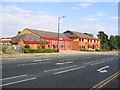
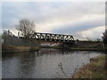
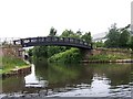
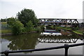
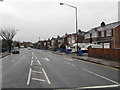
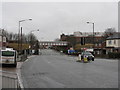
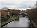
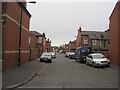
77 photos from this area
Area Information
Key information about the M32 0AY including its size, population, and administrative classification.
- Area Type
- Postcode
- Area Size
- 1.2 hectares
- Population
- 2328
- Population Density
- 7970 people/km²
House Prices in M32 0AY
48
Properties
£161,093
Average Sold Price
£40,000
Lowest Price
£320,000
Highest Price
Showing 48 properties
| Address | Type | Beds | Baths | Last Sale Price | Last Sale Date | |
|---|---|---|---|---|---|---|
| 100 Moss Road, Stretford, M32 0AY | Terraced | 4 | 2 | £320,000 | Feb 2025 | |
| 102 Moss Road, Stretford, M32 0AY | Terraced | 4 | 1 | £315,000 | Jan 2025 | |
| 52 Moss Road, Stretford, M32 0AY | Semi-detached | 3 | 2 | £305,000 | Dec 2022 | |
| 112 Moss Road, Stretford, M32 0AY | house | - | - | £315,000 | Sep 2022 | |
| 52A Moss Road, Stretford, M32 0AY | Semi-detached | 3 | - | £238,000 | Jan 2021 | |
| 114 Moss Road, Stretford, M32 0AY | Semi-detached | 3 | 2 | £250,000 | Jul 2020 | |
| 50 Moss Road, Stretford, M32 0AY | house | - | - | £135,000 | Mar 2016 | |
| 48 Moss Road, Stretford, M32 0AY | Semi-detached | 5 | 2 | £162,000 | Sep 2014 | |
| 108 Moss Road, Stretford, M32 0AY | Terraced | 4 | 1 | £154,000 | Apr 2014 | |
| 128 Moss Road, Stretford, M32 0AY | Flat | - | - | £79,000 | Sep 2013 |
Page 1 of 5
Energy Efficiency in M32 0AY
Amenities
Schools
| Rank | School | Type | Entry gender | Ages |
|---|
Explore more schools in this area
Go to Schools tabDemographics
Household Size
Family (3-5 people)
most common
Accommodation Type
Houses
most common
Tenure
65
majority
Ethnic Group
White
most common
Religion
N/A
most common
Household Composition
N/A
most common
Age
47
median
Adults (30-64 years)
most common
Household Deprivation
N/A
with no deprivation
NS-SEC
35
in Lower managerial occupations
Explore more demographic insights in this area
Go to Demographics tabPlanning
Planning Constraints
- Flood RiskPremium
- Ramsar Wetland SitesPremium
- Area of Outstanding Natural BeautyPremium
- Protected Nature ReservePremium
- Protected WoodlandPremium