Area Overview for M31 1TU
Photos of M31 1TU


Area Information
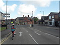
M31 1TU is a small, tightly knit residential postcode in England, home to 1,462 people. The area’s compact nature fosters a quiet, community-focused atmosphere, with homes predominantly in the form of detached or semi-detached houses. Residents here tend to be adults aged 30–64, with a median age of 47, suggesting a stable population of professionals and families. Daily life is shaped by proximity to transport hubs, including five nearby railway stations such as Urmston and Chassen Road, and easy access to Manchester City Airport. The area’s low flood risk and absence of protected natural sites make it a practical choice for those prioritising safety and planning flexibility. However, crime rates here are above average, requiring attention to security. Despite this, the area offers a blend of convenience and accessibility, with retail options like Sainsburys and Tesco within reach, and multiple metro and bus routes facilitating travel to nearby urban centres.
- Area Type
- Postcode
- Area Size
- Not available
- Population
- 1462
- Population Density
- 4888 people/km²
The property market in M31 1TU is defined by a high rate of home ownership—63% of properties are owner-occupied—suggesting a community of long-term residents rather than a transient rental market. The area is dominated by houses, not flats, which aligns with the preference for private, larger homes typical of suburban or semi-rural settings. This makes it an attractive option for buyers seeking family homes or properties with garden space. However, the small size of the postcode means the housing stock is limited, and buyers may need to consider nearby areas for more options. The absence of planning constraints such as protected woodlands or Areas of Outstanding Natural Beauty allows for greater flexibility in property development and renovation. For those prioritising security and stability, the owner-occupied nature of the market may indicate a resilient local economy.
House Prices in M31 1TU
No properties found in this postcode.
Energy Efficiency in M31 1TU
Living in M31 1TU offers access to a range of everyday amenities. Retail options include major supermarkets such as Iceland Urmston, Sainsburys Urmston, and Tesco Urmston, ensuring easy access to groceries and household essentials. The area’s proximity to railway stations like Urmston and Chassen Road, along with metro stops at Trafford Centre and Parkway, makes commuting or day trips to nearby urban centres efficient. While specific parks or leisure facilities are not listed, the presence of multiple transport links suggests nearby green spaces or recreational areas are within reach. The area’s compact size means amenities are closely clustered, reducing the need for long commutes. This combination of retail, transport, and connectivity supports a practical lifestyle, ideal for those who value convenience without sacrificing access to broader opportunities.
Amenities
Schools
| Rank | School | Type | Entry gender | Ages |
|---|
Explore more schools in this area
Go to Schools tabDemographics
The population of M31 1TU is predominantly adults aged 30–64, with a median age of 47. This suggests a mature community, likely composed of long-term residents and families. Home ownership is strong, with 63% of properties occupied by their owners, compared to 37% rented. The area is characterised by houses rather than flats, reflecting a preference for larger, private living spaces. The predominant ethnic group is White, though no further breakdown of diversity is provided. The absence of specific deprivation data means no conclusions can be drawn about economic challenges, but the high home ownership rate and stable age profile indicate a relatively settled population. For buyers, this suggests a community with established roots and a focus on long-term residency over short-term rental turnover.
Household Size
Accommodation Type
Tenure
Ethnic Group
Religion
Household Composition
Age
Household Deprivation
NS-SEC
Explore more demographic insights in this area
Go to Demographics tabPlanning
Planning Constraints
- Flood RiskPremium
- Ramsar Wetland SitesPremium
- Area of Outstanding Natural BeautyPremium
- Protected Nature ReservePremium
- Protected WoodlandPremium